Las Flores geodata
Las Flores (Buenos Aires) is a seat of a second-order administrative division; located in Argentina in America/Argentina/Buenos_Aires (GMT-3) time zone. In our database, there are 785 cities with bigger population. Compared to other cities in Argentina, 81.5% of cities are located further ↑North; 75.4% of cities are located further ←West and 86.2% of cities have higher elevation than Las Flores. Note1


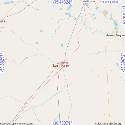
Las Flores GPS coordinates[2]
36° 0' 50.508" South, 59° 5' 59.424" West
| Map corner | latitude | longitude |
|---|---|---|
| Upper-left | -35.44324°, | -59.80297° |
| Center: | -36.01403°, | -59.09984° |
| Lower-right: | -36.58071°, | -58.39672° |
| Map W x H: | 126.5×126.5 km | = 78.6×78.6mi |
| max Lat: | -21.94467° ⇑81.5% North |
| Las Flores: | -36.01403° |
| min Lat: | ⇓18.5% South -54.81084° |
| min Long | Las Flores | max Long |
| -72.88605° | -59.09984° | -53.64581° |
| W 75.4%⇐ | ⇒24.6% E |
Elevation
Elevation of Las Flores is 39 m = 128 ft, and this is 310.3 m = 1018 ft below average elevation for this country.
| Max E: |
4040 m = 13255 ft | 86.2% |
| Avg. | 349.3 m = 1146 ft | |
| Las Flores | 39 m = 128 ft | |
Min E: |
-2 m = -7 ft | 13.8% |
See also: Argentina elevation on elevation.city.
Geographical zone
Las Flores is located in South temperate zone (between Tropic of Capricorn and the Antarctic Circle). Distance of this Southern Tropic circle is 1398.5 km =869 mi to North.| Distance of | km | miles | from Las Flores |
|---|---|---|---|
| Equator | 4004.4 | 2488.2 | to North |
| Tropic Capricorn | 1398.5 | 869 | to North |
| Antarctic Circle | 3396.8 | 2110.7 | to South |
| South Pole | 6002.7 | 3729.9 | to South |


Nearby cities:
15 places around Las Flores: (largest is in red/bold)
• Azul
108.7 km =67.5 mi,  218°
218°
• Cañuelas
111.1 km =69 mi,  15°
15°
• Chascomús
110 km =68.4 mi,  63°
63°
• General Alvear
82.3 km =51.1 mi,  269°
269°
• General Belgrano
61 km =37.9 mi, 63°
• Lobos
92.1 km =57.2 mi,  0°
0°
• Navarro
113.3 km =70.4 mi,  351°
351°
• Pila
86 km =53.4 mi,  89°
89°
• Ranchos
89.6 km =55.7 mi,  51°
51°
• Rauch
84.6 km =52.6 mi,  179°
179°
• Roque Pérez
71.7 km =44.6 mi,  342°
342°
• Saladillo
74.1 km =46 mi,  304°
304°
• San Miguel del Monte
69.1 km =42.9 mi, 22°
• Tapalqué
91.4 km =56.8 mi,  245°
245°
• Veinticinco de Mayo
116.5 km =72.4 mi, 303°
Sources, notices
• [Note1] Compared only with cities in Argentina existing in our database
• [Src1] Map data: © OpenStreetMap contributors (CC-BY-SA)
• [Src2] Other city data from geonames.org with taken over terms of usage.
• [Src3] Geographical zone / Annual Mean Temperature by Robert A. Rohde @ Wikipedia
