Tintina geodata
Tintina (Santiago del Estero) is a populated place; located in Argentina in America/Argentina/Cordoba (GMT-3) time zone. With population of 3,868 people, there are 498 cities with bigger population in this country. Compared to other cities in Argentina, 86.2% of cities are located further ↓South; 50.7% of cities are located further ←West and 53.7% of cities have lower elevation than Tintina. Note1


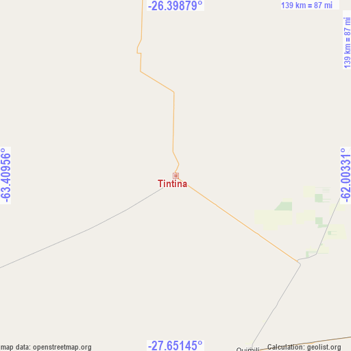
Tintina GPS coordinates[2]
27° 1' 36.732" South, 62° 42' 23.148" West
| Map corner | latitude | longitude |
|---|---|---|
| Upper-left | -26.39879°, | -63.40956° |
| Center: | -27.02687°, | -62.70643° |
| Lower-right: | -27.65145°, | -62.00331° |
| Map W x H: | 139.3×139.3 km | = 86.6×86.6mi |
| max Lat: | -21.94467° ⇑13.8% North |
| Tintina: | -27.02687° |
| min Lat: | ⇓86.2% South -54.81084° |
| min Long | Tintina | max Long |
| -72.88605° | -62.70643° | -53.64581° |
| W 50.7%⇐ | ⇒49.3% E |
Elevation
Elevation of Tintina is 166 m = 545 ft, and this is 183.3 m = 601 ft below average elevation for this country.
| Max E: |
4040 m = 13255 ft | 46.3% |
| Avg. | 349.3 m = 1146 ft | |
| Tintina | 166 m = 545 ft | |
Min E: |
-2 m = -7 ft | 53.7% |
See also: Argentina elevation on elevation.city.
Geographical zone
Tintina is located in South temperate zone (between Tropic of Capricorn and the Antarctic Circle). Distance of this Southern Tropic circle is 399.2 km =248.1 mi to North.| Distance of | km | miles | from Tintina |
|---|---|---|---|
| Equator | 3005.1 | 1867.3 | to North |
| Tropic Capricorn | 399.2 | 248.1 | to North |
| Antarctic Circle | 4396.1 | 2731.6 | to South |
| South Pole | 7002 | 4350.8 | to South |


Nearby cities:
15 places around Tintina: (largest is in red/bold)
• Campo Gallo
51.3 km =31.9 mi,  343°
343°
• Charata
151.7 km =94.3 mi,  97°
97°
• Clodomira
153.4 km =95.3 mi,  246°
246°
• El Hoyo
52.1 km =32.4 mi,  269°
269°
• Fernández
153.6 km =95.4 mi,  229°
229°
• Gancedo
114.2 km =71 mi,  116°
116°
• Garza
149.7 km =93 mi,  213°
213°
• General Pinedo
144.4 km =89.7 mi, 102°
• Hermoso Campo
149.3 km =92.8 mi, 115°
• La Cañada
129.8 km =80.7 mi, 234°
• Los Frentones
145.7 km =90.5 mi,  61°
61°
• Monte Quemado
136.3 km =84.7 mi,  354°
354°
• Pampa de los Guanacos
123.7 km =76.9 mi,  44°
44°
• Quimilí
74.6 km =46.4 mi,  157°
157°
• Suncho Corral
123.5 km =76.7 mi,  215°
215°
Sources, notices
• [Note1] Compared only with cities in Argentina existing in our database
• [Src1] Map data: © OpenStreetMap contributors (CC-BY-SA)
• [Src2] Other city data from geonames.org with taken over terms of usage.
• [Src3] Geographical zone / Annual Mean Temperature by Robert A. Rohde @ Wikipedia
