Campo Gallo geodata
Campo Gallo (Santiago del Estero) is a seat of a second-order administrative division; located in Argentina in America/Argentina/Cordoba (GMT-3) time zone. With population of 5,455 people, there are 425 cities with bigger population in this country. Compared to other cities in Argentina, 89.9% of cities are located further ↓South; 50.9% of cities are located further →East and 58.1% of cities have lower elevation than Campo Gallo. Note1


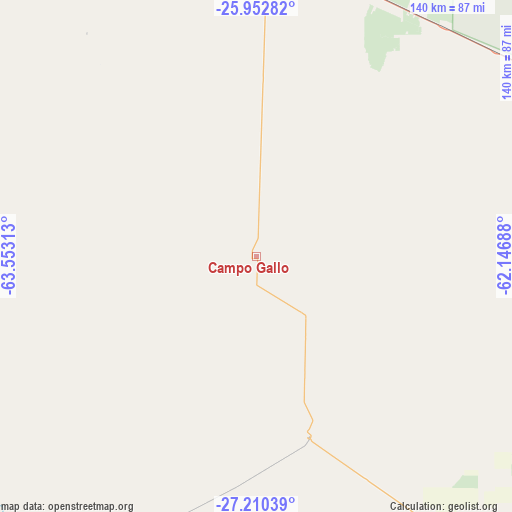
Campo Gallo GPS coordinates[2]
26° 34' 59.988" South, 62° 51' 0" West
| Map corner | latitude | longitude |
|---|---|---|
| Upper-left | -25.95282°, | -63.55313° |
| Center: | -26.58333°, | -62.85° |
| Lower-right: | -27.21039°, | -62.14688° |
| Map W x H: | 139.8×139.8 km | = 86.9×86.9mi |
| max Lat: | -21.94467° ⇑10.1% North |
| Campo Gallo: | -26.58333° |
| min Lat: | ⇓89.9% South -54.81084° |
| min Long | Campo Gallo | max Long |
| -72.88605° | -62.85° | -53.64581° |
| W 49.1%⇐ | ⇒50.9% E |
Elevation
Elevation of Campo Gallo is 194 m = 636 ft, and this is 155.3 m = 510 ft below average elevation for this country.
| Max E: |
4040 m = 13255 ft | 41.9% |
| Avg. | 349.3 m = 1146 ft | |
| Campo Gallo | 194 m = 636 ft | |
Min E: |
-2 m = -7 ft | 58.1% |
See also: Argentina elevation on elevation.city.
Geographical zone
Campo Gallo is located in South temperate zone (between Tropic of Capricorn and the Antarctic Circle). Distance of this Southern Tropic circle is 349.9 km =217.4 mi to North.| Distance of | km | miles | from Campo Gallo |
|---|---|---|---|
| Equator | 2955.8 | 1836.6 | to North |
| Tropic Capricorn | 349.9 | 217.4 | to North |
| Antarctic Circle | 4445.4 | 2762.2 | to South |
| South Pole | 7051.3 | 4381.5 | to South |


Nearby cities:
15 places around Campo Gallo: (largest is in red/bold)
• Clodomira
168 km =104.4 mi,  229°
229°
• El Hoyo
62.4 km =38.8 mi,  217°
217°
• Gancedo
153.9 km =95.6 mi,  130°
130°
• General Pinedo
175.4 km =109 mi,  117°
117°
• La Cañada
154.9 km =96.3 mi, 216°
• Los Frentones
144.3 km =89.7 mi,  82°
82°
• Monte Quemado
86.5 km =53.7 mi,  1°
1°
• Nueva Esperanza
144.7 km =89.9 mi,  287°
287°
• Pampa de los Guanacos
108.2 km =67.2 mi,  68°
68°
• Pampa del Infierno
166.9 km =103.7 mi,  87°
87°
• Pozo Hondo
175.1 km =108.8 mi,  248°
248°
• Quimilí
125.7 km =78.1 mi,  160°
160°
• Suncho Corral
160.7 km =99.9 mi,  200°
200°
• Taco Pozo
115.4 km =71.7 mi,  338°
338°
• Tintina
51.3 km =31.9 mi, 163°
Sources, notices
• [Note1] Compared only with cities in Argentina existing in our database
• [Src1] Map data: © OpenStreetMap contributors (CC-BY-SA)
• [Src2] Other city data from geonames.org with taken over terms of usage.
• [Src3] Geographical zone / Annual Mean Temperature by Robert A. Rohde @ Wikipedia
