Taco Pozo geodata
Taco Pozo (Chaco) is a populated place; located in Argentina in America/Argentina/Cordoba (GMT-3) time zone. With population of 8,470 people, there are 323 cities with bigger population in this country. Compared to other cities in Argentina, 93.2% of cities are located further ↓South; 53.8% of cities are located further →East and 64.3% of cities have lower elevation than Taco Pozo. Note1


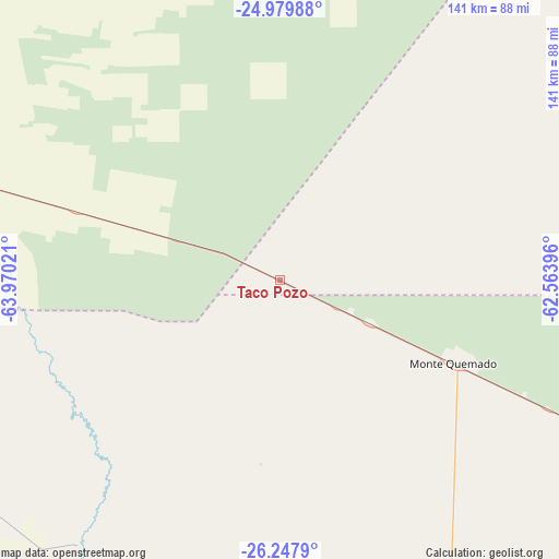
Taco Pozo GPS coordinates[2]
25° 36' 56.052" South, 63° 16' 1.488" West
| Map corner | latitude | longitude |
|---|---|---|
| Upper-left | -24.97988°, | -63.97021° |
| Center: | -25.61557°, | -63.26708° |
| Lower-right: | -26.2479°, | -62.56396° |
| Map W x H: | 141×141 km | = 87.6×87.6mi |
| max Lat: | -21.94467° ⇑6.8% North |
| Taco Pozo: | -25.61557° |
| min Lat: | ⇓93.2% South -54.81084° |
| min Long | Taco Pozo | max Long |
| -72.88605° | -63.26708° | -53.64581° |
| W 46.2%⇐ | ⇒53.8% E |
Elevation
Elevation of Taco Pozo is 261 m = 856 ft, and this is 88.3 m = 290 ft below average elevation for this country.
| Max E: |
4040 m = 13255 ft | 35.7% |
| Avg. | 349.3 m = 1146 ft | |
| Taco Pozo | 261 m = 856 ft | |
Min E: |
-2 m = -7 ft | 64.3% |
See also: Argentina elevation on elevation.city.
Geographical zone
Taco Pozo is located in South temperate zone (between Tropic of Capricorn and the Antarctic Circle). Distance of this Southern Tropic circle is 242.3 km =150.6 mi to North.| Distance of | km | miles | from Taco Pozo |
|---|---|---|---|
| Equator | 2848.2 | 1769.8 | to North |
| Tropic Capricorn | 242.3 | 150.6 | to North |
| Antarctic Circle | 4553 | 2829.1 | to South |
| South Pole | 7158.9 | 4448.3 | to South |


Nearby cities:
15 places around Taco Pozo: (largest is in red/bold)
• Apolinario Saravia
150.6 km =93.6 mi,  330°
330°
• Burruyacú
177.1 km =110 mi,  236°
236°
• Campo Gallo
115.4 km =71.7 mi,  158°
158°
• El Galpón
141.5 km =87.9 mi,  280°
280°
• El Hoyo
157.2 km =97.7 mi,  178°
178°
• El Quebrachal
88.4 km =54.9 mi,  294°
294°
• Joaquín V. González
102.8 km =63.9 mi,  302°
302°
• Las Lajitas
135.8 km =84.4 mi,  316°
316°
• Metán
171.7 km =106.7 mi,  274°
274°
• Monte Quemado
48.6 km =30.2 mi,  115°
115°
• Nueva Esperanza
116.8 km =72.6 mi, 236°
• Pampa de los Guanacos
158.4 km =98.4 mi, 115°
• Rivadavia
163.6 km =101.7 mi,  13°
13°
• Rosario de la Frontera
171.9 km =106.8 mi,  263°
263°
• Tintina
166.6 km =103.5 mi, 160°
Sources, notices
• [Note1] Compared only with cities in Argentina existing in our database
• [Src1] Map data: © OpenStreetMap contributors (CC-BY-SA)
• [Src2] Other city data from geonames.org with taken over terms of usage.
• [Src3] Geographical zone / Annual Mean Temperature by Robert A. Rohde @ Wikipedia
