El Galpón geodata
El Galpón (Salta) is a populated place; located in Argentina in America/Argentina/Salta (GMT-3) time zone. With population of 8,357 people, there are 327 cities with bigger population in this country. Compared to other cities in Argentina, 93.9% of cities are located further ↓South; 70% of cities are located further →East and 78.5% of cities have lower elevation than El Galpón. Note1


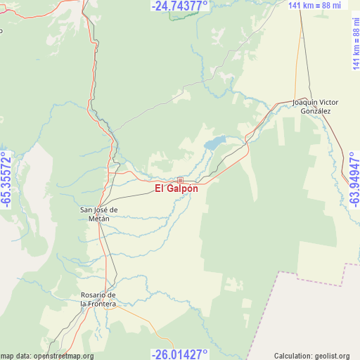
El Galpón GPS coordinates[2]
25° 22' 50.484" South, 64° 39' 9.324" West
| Map corner | latitude | longitude |
|---|---|---|
| Upper-left | -24.74377°, | -65.35572° |
| Center: | -25.38069°, | -64.65259° |
| Lower-right: | -26.01427°, | -63.94947° |
| Map W x H: | 141.3×141.3 km | = 87.8×87.8mi |
| max Lat: | -21.94467° ⇑6.1% North |
| El Galpón: | -25.38069° |
| min Lat: | ⇓93.9% South -54.81084° |
| min Long | El Galpón | max Long |
| -72.88605° | -64.65259° | -53.64581° |
| W 30%⇐ | ⇒70% E |
Elevation
Elevation of El Galpón is 527 m = 1729 ft, and this is 177.7 m = 583 ft above average elevation for this country.
| Max E: |
4040 m = 13255 ft | 21.5% |
| El Galpón | 527 m 1729 ft | |
| Avg. | 349.3 m = 1146 ft | |
Min E: |
-2 m = -7 ft | 78.5% |
See also: Argentina elevation on elevation.city.
Geographical zone
El Galpón is located in South temperate zone (between Tropic of Capricorn and the Antarctic Circle). Distance of this Southern Tropic circle is 216.1 km =134.3 mi to North.| Distance of | km | miles | from El Galpón |
|---|---|---|---|
| Equator | 2822.1 | 1753.6 | to North |
| Tropic Capricorn | 216.1 | 134.3 | to North |
| Antarctic Circle | 4579.1 | 2845.3 | to South |
| South Pole | 7185 | 4464.6 | to South |


Nearby cities:
15 places around El Galpón: (largest is in red/bold)
• Cerrillos
99.7 km =62 mi,  302°
302°
• Chicoana
93.9 km =58.3 mi,  289°
289°
• El Carril
91 km =56.5 mi, 291°
• El Quebrachal
59.9 km =37.2 mi,  79°
79°
• General Martín Miguel de Güemes
88.4 km =54.9 mi,  333°
333°
• Guachipas
87.4 km =54.3 mi,  259°
259°
• Joaquín V. González
60.7 km =37.7 mi,  60°
60°
• La Candelaria
92 km =57.2 mi,  205°
205°
• La Viña
92.3 km =57.4 mi, 264°
• Las Lajitas
86.1 km =53.5 mi,  32°
32°
• Metán
34.8 km =21.6 mi,  247°
247°
• Nueva Esperanza
100 km =62.1 mi,  155°
155°
• Rosario de Lerma
103.2 km =64.1 mi, 295°
• Rosario de la Frontera
56.2 km =34.9 mi, 214°
• Salta
101.1 km =62.8 mi,  310°
310°
Sources, notices
• [Note1] Compared only with cities in Argentina existing in our database
• [Src1] Map data: © OpenStreetMap contributors (CC-BY-SA)
• [Src2] Other city data from geonames.org with taken over terms of usage.
• [Src3] Geographical zone / Annual Mean Temperature by Robert A. Rohde @ Wikipedia
