Gaimán geodata
Gaimán (Chubut) is a seat of a second-order administrative division; located in Argentina in America/Argentina/Catamarca (GMT-3) time zone. With population of 5,753 people, there are 408 cities with bigger population in this country. Compared to other cities in Argentina, 96.7% of cities are located further ↑North; 77.8% of cities are located further →East and 93.5% of cities have higher elevation than Gaimán. Note1


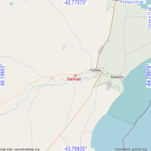
Gaimán GPS coordinates[2]
43° 17' 22.92" South, 65° 29' 34.44" West
| Map corner | latitude | longitude |
|---|---|---|
| Upper-left | -42.77575°, | -66.19603° |
| Center: | -43.2897°, | -65.4929° |
| Lower-right: | -43.79935°, | -64.78978° |
| Map W x H: | 113.8×113.8 km | = 70.7×70.7mi |
| max Lat: | -21.94467° ⇑96.7% North |
| Gaimán: | -43.2897° |
| min Lat: | ⇓3.3% South -54.81084° |
| min Long | Gaimán | max Long |
| -72.88605° | -65.4929° | -53.64581° |
| W 22.2%⇐ | ⇒77.8% E |
Elevation
Elevation of Gaimán is 21 m = 69 ft, and this is 328.3 m = 1077 ft below average elevation for this country.
| Max E: |
4040 m = 13255 ft | 93.5% |
| Avg. | 349.3 m = 1146 ft | |
| Gaimán | 21 m = 69 ft | |
Min E: |
-2 m = -7 ft | 6.5% |
See also: Argentina elevation on elevation.city.
Geographical zone
Gaimán is located in South temperate zone (between Tropic of Capricorn and the Antarctic Circle). Distance of this Southern Tropic circle is 2207.4 km =1371.6 mi to North.| Distance of | km | miles | from Gaimán |
|---|---|---|---|
| Equator | 4813.4 | 2990.9 | to North |
| Tropic Capricorn | 2207.4 | 1371.6 | to North |
| Antarctic Circle | 2587.8 | 1608 | to South |
| South Pole | 5193.7 | 3227.2 | to South |


Nearby cities:
15 places around Gaimán: (largest is in red/bold)
• Camarones
168.5 km =104.7 mi,  185°
185°
• Comodoro Rivadavia
327.3 km =203.4 mi,  208°
208°
• Dolavón
17.4 km =10.8 mi,  263°
263°
• Gastre
325 km =201.9 mi,  290°
290°
• Las Plumas
152.1 km =94.5 mi,  251°
251°
• Paso de Indios
293.2 km =182.2 mi, 257°
• Puerto Madryn
68.7 km =42.7 mi,  32°
32°
• Rada Tilly
335.3 km =208.3 mi, 209°
• Rawson
31.6 km =19.6 mi,  92°
92°
• San Antonio Oeste
287.9 km =178.9 mi,  8°
8°
• Sierra Grande
187.5 km =116.5 mi,  3°
3°
• Telsen
151.5 km =94.1 mi,  308°
308°
• Trelew
15.9 km =9.9 mi,  73°
73°
• Valcheta
295.4 km =183.6 mi,  349°
349°
• Viedma
343.9 km =213.7 mi,  36°
36°
Sources, notices
• [Note1] Compared only with cities in Argentina existing in our database
• [Src1] Map data: © OpenStreetMap contributors (CC-BY-SA)
• [Src2] Other city data from geonames.org with taken over terms of usage.
• [Src3] Geographical zone / Annual Mean Temperature by Robert A. Rohde @ Wikipedia
