Serrezuela geodata
Serrezuela (Cordoba) is a populated place; located in Argentina in America/Argentina/Cordoba (GMT-3) time zone. With population of 2,291 people, there are 609 cities with bigger population in this country. Compared to other cities in Argentina, 62.3% of cities are located further ↓South; 76.7% of cities are located further →East and 65.4% of cities have lower elevation than Serrezuela. Note1


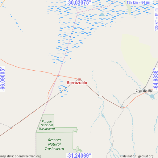
Serrezuela GPS coordinates[2]
30° 38' 15.396" South, 65° 23' 12.912" West
| Map corner | latitude | longitude |
|---|---|---|
| Upper-left | -30.03075°, | -66.09005° |
| Center: | -30.63761°, | -65.38692° |
| Lower-right: | -31.24069°, | -64.6838° |
| Map W x H: | 134.5×134.5 km | = 83.6×83.6mi |
| max Lat: | -21.94467° ⇑37.7% North |
| Serrezuela: | -30.63761° |
| min Lat: | ⇓62.3% South -54.81084° |
| min Long | Serrezuela | max Long |
| -72.88605° | -65.38692° | -53.64581° |
| W 23.3%⇐ | ⇒76.7% E |
Elevation
Elevation of Serrezuela is 280 m = 919 ft, and this is 69.3 m = 227 ft below average elevation for this country.
| Max E: |
4040 m = 13255 ft | 34.6% |
| Avg. | 349.3 m = 1146 ft | |
| Serrezuela | 280 m = 919 ft | |
Min E: |
-2 m = -7 ft | 65.4% |
See also: Argentina elevation on elevation.city.
Geographical zone
Serrezuela is located in South temperate zone (between Tropic of Capricorn and the Antarctic Circle). Distance of this Southern Tropic circle is 800.7 km =497.5 mi to North.| Distance of | km | miles | from Serrezuela |
|---|---|---|---|
| Equator | 3406.6 | 2116.8 | to North |
| Tropic Capricorn | 800.7 | 497.5 | to North |
| Antarctic Circle | 3994.6 | 2482.1 | to South |
| South Pole | 6600.5 | 4101.4 | to South |


Nearby cities:
15 places around Serrezuela: (largest is in red/bold)
• Capilla del Monte
86 km =53.4 mi,  106°
106°
• Castro Barros
33.2 km =20.6 mi,  281°
281°
• Chamical
94 km =58.4 mi,  289°
289°
• Cruz del Eje
56.6 km =35.2 mi,  100°
100°
• Huerta Grande
98.4 km =61.1 mi,  119°
119°
• La Cumbre
93.7 km =58.2 mi, 114°
• La Falda
99.2 km =61.6 mi, 120°
• Los Cocos
90.4 km =56.2 mi, 110°
• Milagro
70.9 km =44.1 mi,  234°
234°
• Olta
83.8 km =52.1 mi,  270°
270°
• Quilino
97.2 km =60.4 mi,  60°
60°
• Salsacate
80.8 km =50.2 mi,  159°
159°
• San Carlos
65.9 km =40.9 mi, 155°
• Villa Giardino
96.8 km =60.1 mi, 117°
• Villa de Soto
44.2 km =27.5 mi, 123°
Sources, notices
• [Note1] Compared only with cities in Argentina existing in our database
• [Src1] Map data: © OpenStreetMap contributors (CC-BY-SA)
• [Src2] Other city data from geonames.org with taken over terms of usage.
• [Src3] Geographical zone / Annual Mean Temperature by Robert A. Rohde @ Wikipedia
