Cachí geodata
Cachí (Salta) is a seat of a second-order administrative division; located in Argentina in America/Argentina/Salta (GMT-3) time zone. With population of 2,189 people, there are 620 cities with bigger population in this country. Compared to other cities in Argentina, 94.6% of cities are located further ↓South; 83% of cities are located further →East and 98.5% of cities have lower elevation than Cachí. Note1


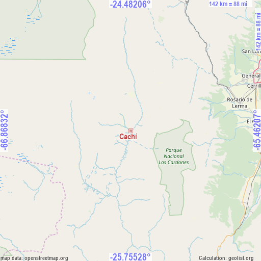
Cachí GPS coordinates[2]
25° 7' 13.188" South, 66° 9' 54.684" West
| Map corner | latitude | longitude |
|---|---|---|
| Upper-left | -24.48206°, | -66.86832° |
| Center: | -25.12033°, | -66.16519° |
| Lower-right: | -25.75528°, | -65.46207° |
| Map W x H: | 141.6×141.6 km | = 88×88mi |
| max Lat: | -21.94467° ⇑5.4% North |
| Cachí: | -25.12033° |
| min Lat: | ⇓94.6% South -54.81084° |
| min Long | Cachí | max Long |
| -72.88605° | -66.16519° | -53.64581° |
| W 17%⇐ | ⇒83% E |
Elevation
Elevation of Cachí is 2355 m = 7726 ft, and this is 2005.7 m = 6580 ft above average elevation for this country.
| Max E: |
4040 m = 13255 ft | 1.5% |
| Cachí | 2355 m 7726 ft | |
| Avg. | 349.3 m = 1146 ft | |
Min E: |
-2 m = -7 ft | 98.5% |
See also: Argentina elevation on elevation.city.
Geographical zone
Cachí is located in South temperate zone (between Tropic of Capricorn and the Antarctic Circle). Distance of this Southern Tropic circle is 187.2 km =116.3 mi to North.| Distance of | km | miles | from Cachí |
|---|---|---|---|
| Equator | 2793.1 | 1735.6 | to North |
| Tropic Capricorn | 187.2 | 116.3 | to North |
| Antarctic Circle | 4608.1 | 2863.3 | to South |
| South Pole | 7213.9 | 4482.5 | to South |


Nearby cities:
15 places around Cachí: (largest is in red/bold)
• Cafayate
107.6 km =66.9 mi,  169°
169°
• Campo Quijano
58.2 km =36.2 mi,  66°
66°
• Cerrillos
72.7 km =45.2 mi, 70°
• Chicoana
63.5 km =39.5 mi,  88°
88°
• El Carril
68 km =42.3 mi, 85°
• Guachipas
79.5 km =49.4 mi,  124°
124°
• La Caldera
97.6 km =60.6 mi,  54°
54°
• La Poma
44.4 km =27.6 mi,  355°
355°
• La Viña
71.5 km =44.4 mi, 122°
• Molinos
37.8 km =23.5 mi,  200°
200°
• Rosario de Lerma
61 km =37.9 mi,  75°
75°
• Salta
84.6 km =52.6 mi,  63°
63°
• San Antonio de los Cobres
101.5 km =63.1 mi,  351°
351°
• San Carlos
88.4 km =54.9 mi,  164°
164°
• Santa Rosa de Tastil
76.8 km =47.7 mi,  14°
14°
Sources, notices
• [Note1] Compared only with cities in Argentina existing in our database
• [Src1] Map data: © OpenStreetMap contributors (CC-BY-SA)
• [Src2] Other city data from geonames.org with taken over terms of usage.
• [Src3] Geographical zone / Annual Mean Temperature by Robert A. Rohde @ Wikipedia
