San Jorge geodata
San Jorge (Santa Fe) is a populated place; located in Argentina in America/Argentina/Cordoba (GMT-3) time zone. With population of 16,873 people, there are 208 cities with bigger population in this country. Compared to other cities in Argentina, 50.7% of cities are located further ↑North; 56% of cities are located further ←West and 59.8% of cities have higher elevation than San Jorge. Note1


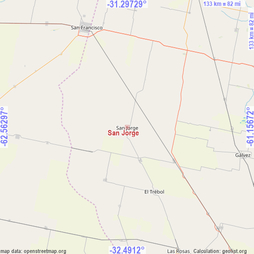
San Jorge GPS coordinates[2]
31° 53' 46.248" South, 61° 51' 35.424" West
| Map corner | latitude | longitude |
|---|---|---|
| Upper-left | -31.29729°, | -62.56297° |
| Center: | -31.89618°, | -61.85984° |
| Lower-right: | -32.4912°, | -61.15672° |
| Map W x H: | 132.8×132.8 km | = 82.5×82.5mi |
| max Lat: | -21.94467° ⇑50.7% North |
| San Jorge: | -31.89618° |
| min Lat: | ⇓49.3% South -54.81084° |
| min Long | San Jorge | max Long |
| -72.88605° | -61.85984° | -53.64581° |
| W 56%⇐ | ⇒44% E |
Elevation
Elevation of San Jorge is 109 m = 358 ft, and this is 240.3 m = 788 ft below average elevation for this country.
| Max E: |
4040 m = 13255 ft | 59.8% |
| Avg. | 349.3 m = 1146 ft | |
| San Jorge | 109 m = 358 ft | |
Min E: |
-2 m = -7 ft | 40.2% |
See also: Argentina elevation on elevation.city.
Geographical zone
San Jorge is located in South temperate zone (between Tropic of Capricorn and the Antarctic Circle). Distance of this Southern Tropic circle is 940.6 km =584.5 mi to North.| Distance of | km | miles | from San Jorge |
|---|---|---|---|
| Equator | 3546.5 | 2203.7 | to North |
| Tropic Capricorn | 940.6 | 584.5 | to North |
| Antarctic Circle | 3854.7 | 2395.2 | to South |
| South Pole | 6460.5 | 4014.4 | to South |


Nearby cities:
15 places around San Jorge: (largest is in red/bold)
• Bella Italia
80.5 km =50 mi,  31°
31°
• Cintra
87.5 km =54.4 mi,  238°
238°
• Devoto
69.1 km =42.9 mi,  322°
322°
• El Trébol
37 km =23 mi,  156°
156°
• Gálvez
62.1 km =38.6 mi,  103°
103°
• Las Rosas
69.7 km =43.3 mi, 157°
• Las Varas
72.2 km =44.9 mi,  278°
278°
• Las Varillas
81.2 km =50.5 mi,  271°
271°
• Noetinger
67.3 km =41.8 mi,  219°
219°
• Rafaela
80 km =49.7 mi, 26°
• San Antonio de Litín
80.9 km =50.3 mi, 244°
• San Carlos Centro
74.9 km =46.5 mi,  75°
75°
• San Francisco
56.2 km =34.9 mi,  337°
337°
• Sastre
14.6 km =9.1 mi,  11°
11°
• Saturnino M. Laspiur
62.6 km =38.9 mi,  290°
290°
Sources, notices
• [Note1] Compared only with cities in Argentina existing in our database
• [Src1] Map data: © OpenStreetMap contributors (CC-BY-SA)
• [Src2] Other city data from geonames.org with taken over terms of usage.
• [Src3] Geographical zone / Annual Mean Temperature by Robert A. Rohde @ Wikipedia
