Mendoza geodata
Mendoza is a seat of a first-order administrative division; located in Argentina in America/Argentina/Mendoza (GMT-3) time zone. With population of 876,884 people, there are 3 cities with bigger population in this country. Compared to other cities in Argentina, 60.6% of cities are located further ↑North; 93.8% of cities are located further →East and 87.1% of cities have lower elevation than Mendoza. Note1


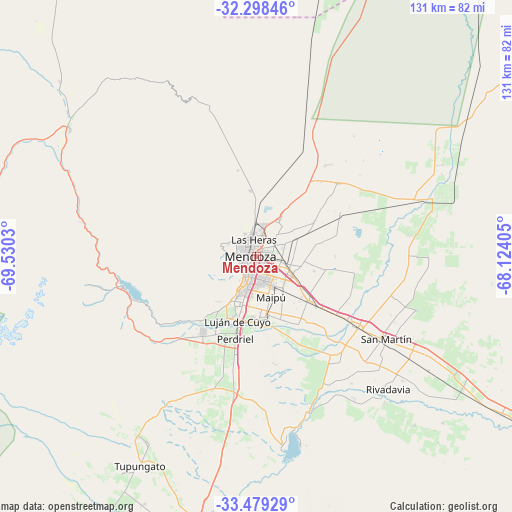
Mendoza GPS coordinates[2]
32° 53' 27.024" South, 68° 49' 37.812" West
| Map corner | latitude | longitude |
|---|---|---|
| Upper-left | -32.29846°, | -69.5303° |
| Center: | -32.89084°, | -68.82717° |
| Lower-right: | -33.47929°, | -68.12405° |
| Map W x H: | 131.3×131.3 km | = 81.6×81.6mi |
| max Lat: | -21.94467° ⇑60.6% North |
| Mendoza: | -32.89084° |
| min Lat: | ⇓39.4% South -54.81084° |
| min Long | Mendoza | max Long |
| -72.88605° | -68.82717° | -53.64581° |
| W 6.2%⇐ | ⇒93.8% E |
Elevation
Elevation of Mendoza is 746 m = 2448 ft, and this is 396.7 m = 1302 ft above average elevation for this country.
| Max E: |
4040 m = 13255 ft | 12.9% |
| Mendoza | 746 m 2448 ft | |
| Avg. | 349.3 m = 1146 ft | |
Min E: |
-2 m = -7 ft | 87.1% |
See also: Mendoza elevation on elevation.city.
Geographical zone
Mendoza is located in South temperate zone (between Tropic of Capricorn and the Antarctic Circle). Distance of this Southern Tropic circle is 1051.2 km =653.2 mi to North.| Distance of | km | miles | from Mendoza |
|---|---|---|---|
| Equator | 3657.1 | 2272.4 | to North |
| Tropic Capricorn | 1051.2 | 653.2 | to North |
| Antarctic Circle | 3744.1 | 2326.5 | to South |
| South Pole | 6349.9 | 3945.6 | to South |


Nearby cities:
15 places around Mendoza: (largest is in red/bold)
• General Lavalle
28.9 km =18 mi,  49°
49°
• Godoy Cruz
4.3 km =2.7 mi,  189°
189°
• Junín
43.2 km =26.8 mi,  131°
131°
• La Consulta
97.9 km =60.8 mi,  196°
196°
• Las Heras
4.2 km =2.6 mi,  358°
358°
• Luján de Cuyo
16.8 km =10.4 mi, 196°
• Maipú
10.6 km =6.6 mi,  158°
158°
• Primero de Mayo
79.3 km =49.3 mi,  28°
28°
• Rivadavia
47.7 km =29.6 mi, 134°
• San Martín
39.6 km =24.6 mi,  122°
122°
• Santa Rosa
75 km =46.6 mi, 122°
• Tunuyán
78.2 km =48.6 mi, 192°
• Tupungato
61.2 km =38 mi,  209°
209°
• Villa Media Agua
107.8 km =67 mi,  20°
20°
• Villa Nueva
4.4 km =2.7 mi,  99°
99°
Sources, notices
• [Note1] Compared only with cities in Argentina existing in our database
• [Src1] Map data: © OpenStreetMap contributors (CC-BY-SA)
• [Src2] Other city data from geonames.org with taken over terms of usage.
• [Src3] Geographical zone / Annual Mean Temperature by Robert A. Rohde @ Wikipedia
