Maquinchao geodata
Maquinchao (Rio Negro) is a seat of a second-order administrative division; located in Argentina in America/Argentina/Salta (GMT-3) time zone. With population of 2,195 people, there are 618 cities with bigger population in this country. Compared to other cities in Argentina, 95.2% of cities are located further ↑North; 93.2% of cities are located further →East and 90.9% of cities have lower elevation than Maquinchao. Note1


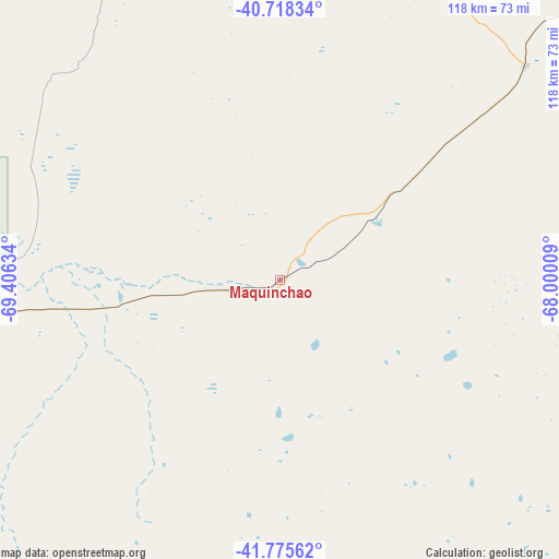
Maquinchao GPS coordinates[2]
41° 14' 56.832" South, 68° 42' 11.556" West
| Map corner | latitude | longitude |
|---|---|---|
| Upper-left | -40.71834°, | -69.40634° |
| Center: | -41.24912°, | -68.70321° |
| Lower-right: | -41.77562°, | -68.00009° |
| Map W x H: | 117.6×117.6 km | = 73.1×73.1mi |
| max Lat: | -21.94467° ⇑95.2% North |
| Maquinchao: | -41.24912° |
| min Lat: | ⇓4.8% South -54.81084° |
| min Long | Maquinchao | max Long |
| -72.88605° | -68.70321° | -53.64581° |
| W 6.8%⇐ | ⇒93.2% E |
Elevation
Elevation of Maquinchao is 898 m = 2946 ft, and this is 548.7 m = 1800 ft above average elevation for this country.
| Max E: |
4040 m = 13255 ft | 9.1% |
| Maquinchao | 898 m 2946 ft | |
| Avg. | 349.3 m = 1146 ft | |
Min E: |
-2 m = -7 ft | 90.9% |
See also: Argentina elevation on elevation.city.
Geographical zone
Maquinchao is located in South temperate zone (between Tropic of Capricorn and the Antarctic Circle). Distance of this Southern Tropic circle is 1980.6 km =1230.7 mi to North.| Distance of | km | miles | from Maquinchao |
|---|---|---|---|
| Equator | 4586.5 | 2849.9 | to North |
| Tropic Capricorn | 1980.6 | 1230.7 | to North |
| Antarctic Circle | 2814.7 | 1749 | to South |
| South Pole | 5420.6 | 3368.2 | to South |


Nearby cities:
15 places around Maquinchao: (largest is in red/bold)
• Comallo
133.3 km =82.8 mi,  280°
280°
• El Cuy
150.2 km =93.3 mi,  11°
11°
• El Maitén
223.2 km =138.7 mi,  246°
246°
• Gastre
120.5 km =74.9 mi,  200°
200°
• Ingeniero Jacobacci
71.3 km =44.3 mi,  262°
262°
• Leleque
234.7 km =145.8 mi,  236°
236°
• Los Menucos
68.5 km =42.6 mi,  48°
48°
• Picún Leufú
198.9 km =123.6 mi,  345°
345°
• Piedra del Águila
176.7 km =109.8 mi,  319°
319°
• Pilcaniyeu
169.5 km =105.3 mi,  274°
274°
• San Carlos de Bariloche
218.2 km =135.6 mi, 273°
• Sierra Colorada
108.5 km =67.4 mi, 47°
• Telsen
196.8 km =122.3 mi,  132°
132°
• Valcheta
222.5 km =138.3 mi,  73°
73°
• Ñorquinco
194.8 km =121 mi, 249°
Sources, notices
• [Note1] Compared only with cities in Argentina existing in our database
• [Src1] Map data: © OpenStreetMap contributors (CC-BY-SA)
• [Src2] Other city data from geonames.org with taken over terms of usage.
• [Src3] Geographical zone / Annual Mean Temperature by Robert A. Rohde @ Wikipedia
