Gastre geodata
Gastre (Chubut) is a seat of a second-order administrative division; located in Argentina in America/Argentina/Catamarca (GMT-3) time zone. In our database, there are 785 cities with bigger population. Compared to other cities in Argentina, 96% of cities are located further ↑North; 95.3% of cities are located further →East and 92.8% of cities have lower elevation than Gastre. Note1


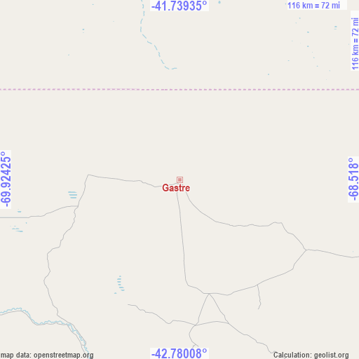
Gastre GPS coordinates[2]
42° 15' 42.696" South, 69° 13' 16.032" West
| Map corner | latitude | longitude |
|---|---|---|
| Upper-left | -41.73935°, | -69.92425° |
| Center: | -42.26186°, | -69.22112° |
| Lower-right: | -42.78008°, | -68.518° |
| Map W x H: | 115.7×115.7 km | = 71.9×71.9mi |
| max Lat: | -21.94467° ⇑96% North |
| Gastre: | -42.26186° |
| min Lat: | ⇓4% South -54.81084° |
| min Long | Gastre | max Long |
| -72.88605° | -69.22112° | -53.64581° |
| W 4.7%⇐ | ⇒95.3% E |
Elevation
Elevation of Gastre is 1034 m = 3392 ft, and this is 684.7 m = 2246 ft above average elevation for this country.
| Max E: |
4040 m = 13255 ft | 7.2% |
| Gastre | 1034 m 3392 ft | |
| Avg. | 349.3 m = 1146 ft | |
Min E: |
-2 m = -7 ft | 92.8% |
See also: Argentina elevation on elevation.city.
Geographical zone
Gastre is located in South temperate zone (between Tropic of Capricorn and the Antarctic Circle). Distance of this Southern Tropic circle is 2093.2 km =1300.7 mi to North.| Distance of | km | miles | from Gastre |
|---|---|---|---|
| Equator | 4699.1 | 2919.9 | to North |
| Tropic Capricorn | 2093.2 | 1300.7 | to North |
| Antarctic Circle | 2702.1 | 1679 | to South |
| South Pole | 5308 | 3298.2 | to South |


Nearby cities:
15 places around Gastre: (largest is in red/bold)
• Comallo
162.3 km =100.8 mi,  327°
327°
• El Bolsón
193.6 km =120.3 mi,  279°
279°
• El Maitén
162.1 km =100.7 mi, 278°
• Esquel
186.3 km =115.8 mi,  247°
247°
• Hoyo de Epuyén
189.7 km =117.9 mi, 276°
• Ingeniero Jacobacci
107.2 km =66.6 mi,  345°
345°
• Lago Puelo
197.6 km =122.8 mi, 276°
• Leleque
152.7 km =94.9 mi,  263°
263°
• Los Menucos
183.7 km =114.1 mi,  30°
30°
• Maquinchao
120.5 km =74.9 mi,  20°
20°
• Paso de Indios
178.5 km =110.9 mi,  175°
175°
• Pilcaniyeu
177.6 km =110.4 mi,  315°
315°
• Tecka
188.6 km =117.2 mi,  223°
223°
• Telsen
188.4 km =117.1 mi,  95°
95°
• Ñorquinco
146.1 km =90.8 mi,  288°
288°
Sources, notices
• [Note1] Compared only with cities in Argentina existing in our database
• [Src1] Map data: © OpenStreetMap contributors (CC-BY-SA)
• [Src2] Other city data from geonames.org with taken over terms of usage.
• [Src3] Geographical zone / Annual Mean Temperature by Robert A. Rohde @ Wikipedia
