Comallo geodata
Comallo (Rio Negro) is a populated place; located in Argentina in America/Argentina/Salta (GMT-3) time zone. With population of 1,306 people, there are 725 cities with bigger population in this country. Compared to other cities in Argentina, 94.9% of cities are located further ↑North; 96.7% of cities are located further →East and 87.5% of cities have lower elevation than Comallo. Note1


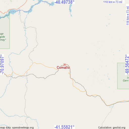
Comallo GPS coordinates[2]
41° 1' 47.748" South, 70° 16' 4.224" West
| Map corner | latitude | longitude |
|---|---|---|
| Upper-left | -40.49738°, | -70.97097° |
| Center: | -41.02993°, | -70.26784° |
| Lower-right: | -41.55821°, | -69.56472° |
| Map W x H: | 118×118 km | = 73.3×73.3mi |
| max Lat: | -21.94467° ⇑94.9% North |
| Comallo: | -41.02993° |
| min Lat: | ⇓5.1% South -54.81084° |
| min Long | Comallo | max Long |
| -72.88605° | -70.26784° | -53.64581° |
| W 3.3%⇐ | ⇒96.7% E |
Elevation
Elevation of Comallo is 772 m = 2533 ft, and this is 422.7 m = 1387 ft above average elevation for this country.
| Max E: |
4040 m = 13255 ft | 12.5% |
| Comallo | 772 m 2533 ft | |
| Avg. | 349.3 m = 1146 ft | |
Min E: |
-2 m = -7 ft | 87.5% |
See also: Argentina elevation on elevation.city.
Geographical zone
Comallo is located in South temperate zone (between Tropic of Capricorn and the Antarctic Circle). Distance of this Southern Tropic circle is 1956.2 km =1215.5 mi to North.| Distance of | km | miles | from Comallo |
|---|---|---|---|
| Equator | 4562.1 | 2834.8 | to North |
| Tropic Capricorn | 1956.2 | 1215.5 | to North |
| Antarctic Circle | 2839.1 | 1764.1 | to South |
| South Pole | 5445 | 3383.4 | to South |


Nearby cities:
15 places around Comallo: (largest is in red/bold)
• El Bolsón
147.7 km =91.8 mi,  225°
225°
• El Maitén
135.8 km =84.4 mi,  213°
213°
• Gastre
162.3 km =100.8 mi,  147°
147°
• Hoyo de Epuyén
155.2 km =96.4 mi,  221°
221°
• Ingeniero Jacobacci
68.7 km =42.7 mi,  118°
118°
• Junín de los Andes
137.8 km =85.6 mi,  330°
330°
• Lago Puelo
160.2 km =99.5 mi, 223°
• Las Coloradas
166.3 km =103.3 mi,  350°
350°
• Maquinchao
133.3 km =82.8 mi,  100°
100°
• Piedra del Águila
110.4 km =68.6 mi,  8°
8°
• Pilcaniyeu
39.4 km =24.5 mi,  254°
254°
• San Carlos de Bariloche
88.1 km =54.7 mi,  261°
261°
• San Martín de los Andes
133.4 km =82.9 mi,  316°
316°
• Villa La Angostura
119.6 km =74.3 mi,  284°
284°
• Ñorquinco
105.5 km =65.6 mi, 210°
Sources, notices
• [Note1] Compared only with cities in Argentina existing in our database
• [Src1] Map data: © OpenStreetMap contributors (CC-BY-SA)
• [Src2] Other city data from geonames.org with taken over terms of usage.
• [Src3] Geographical zone / Annual Mean Temperature by Robert A. Rohde @ Wikipedia
