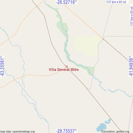
Villa General Mitre geodata
Villa General Mitre (Santiago del Estero) is a populated place; located in Argentina in America/Argentina/Cordoba (GMT-3) time zone. With population of 3,605 people, there are 516 cities with bigger population in this country. Compared to other cities in Argentina, 68% of cities are located further ↓South; 51.3% of cities are located further ←West and 66.6% of cities have higher elevation than Villa General Mitre. Note1
Villa General Mitre GPS coordinates[2]
29° 8' 35.16" South, 62° 39' 8.928" West
| Map corner | latitude | longitude |
|---|---|---|
| Upper-left | -28.52716°, | -63.35561° |
| Center: | -29.1431°, | -62.65248° |
| Lower-right: | -29.75537°, | -61.94936° |
| Map W x H: | 136.6×136.6 km | = 84.9×84.9mi |
| max Lat: | -21.94467° ⇑32% North |
| Villa General Mitre: | -29.1431° |
| min Lat: | ⇓68% South -54.81084° |
| min Long | Villa General M | max Long |
| -72.88605° | -62.65248° | -53.64581° |
| W 51.3%⇐ | ⇒48.7% E |
Elevation
Elevation of Villa General Mitre is 90 m = 295 ft, and this is 259.3 m = 851 ft below average elevation for this country.
| Max E: |
4040 m = 13255 ft | 66.6% |
| Avg. | 349.3 m = 1146 ft | |
| Villa General Mitre | 90 m = 295 ft | |
Min E: |
-2 m = -7 ft | 33.4% |
See also: Argentina elevation on elevation.city.
Geographical zone
Villa General Mitre is located in South temperate zone (between Tropic of Capricorn and the Antarctic Circle). Distance of this Southern Tropic circle is 634.5 km =394.3 mi to North.| Distance of | km | miles | from Villa General Mitre |
|---|---|---|---|
| Equator | 3240.4 | 2013.5 | to North |
| Tropic Capricorn | 634.5 | 394.3 | to North |
| Antarctic Circle | 4160.8 | 2585.4 | to South |
| South Pole | 6766.7 | 4204.6 | to South |


Nearby cities:
15 places around Villa General Mitre: (largest is in red/bold)
• Añatuya
77.9 km =48.4 mi,  346°
346°
• Bandera
47.1 km =29.3 mi,  52°
52°
• Ceres
106.9 km =66.4 mi,  140°
140°
• Colonia Dora
67 km =41.6 mi,  334°
334°
• Herrera
84 km =52.2 mi,  331°
331°
• Hersilia
123.8 km =76.9 mi,  140°
140°
• Los Juríes
92.1 km =57.2 mi,  35°
35°
• Los Telares
79.4 km =49.3 mi,  282°
282°
• Selva
90.8 km =56.4 mi,  139°
139°
• Sumampa
83.6 km =51.9 mi,  251°
251°
• Tostado
86.3 km =53.6 mi,  96°
96°
• Villa Atamisqui
134.3 km =83.5 mi,  302°
302°
• Villa Ojo de Agua
108.5 km =67.4 mi,  248°
248°
• Villa Unión
32.8 km =20.4 mi,  203°
203°
• Villa de María
133.6 km =83 mi,  230°
230°
Sources, notices
• [Note1] Compared only with cities in Argentina existing in our database
• [Src1] Map data: © OpenStreetMap contributors (CC-BY-SA)
• [Src2] Other city data from geonames.org with taken over terms of usage.
• [Src3] Geographical zone / Annual Mean Temperature by Robert A. Rohde @ Wikipedia


