Alta Gracia geodata
Alta Gracia (Cordoba) is a seat of a second-order administrative division; located in Argentina in America/Argentina/Cordoba (GMT-3) time zone. With population of 40,384 people, there are 107 cities with bigger population in this country. Compared to other cities in Argentina, 52% of cities are located further ↓South; 67.2% of cities are located further →East and 79.9% of cities have lower elevation than Alta Gracia. Note1


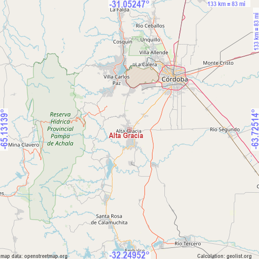
Alta Gracia GPS coordinates[2]
31° 39' 10.512" South, 64° 25' 41.736" West
| Map corner | latitude | longitude |
|---|---|---|
| Upper-left | -31.05247°, | -65.13139° |
| Center: | -31.65292°, | -64.42826° |
| Lower-right: | -32.24952°, | -63.72514° |
| Map W x H: | 133.1×133.1 km | = 82.7×82.7mi |
| max Lat: | -21.94467° ⇑48% North |
| Alta Gracia: | -31.65292° |
| min Lat: | ⇓52% South -54.81084° |
| min Long | Alta Gracia | max Long |
| -72.88605° | -64.42826° | -53.64581° |
| W 32.8%⇐ | ⇒67.2% E |
Elevation
Elevation of Alta Gracia is 556 m = 1824 ft, and this is 206.7 m = 678 ft above average elevation for this country.
| Max E: |
4040 m = 13255 ft | 20.1% |
| Alta Gracia | 556 m 1824 ft | |
| Avg. | 349.3 m = 1146 ft | |
Min E: |
-2 m = -7 ft | 79.9% |
See also: Alta Gracia elevation on elevation.city.
Geographical zone
Alta Gracia is located in South temperate zone (between Tropic of Capricorn and the Antarctic Circle). Distance of this Southern Tropic circle is 913.6 km =567.7 mi to North.| Distance of | km | miles | from Alta Gracia |
|---|---|---|---|
| Equator | 3519.5 | 2186.9 | to North |
| Tropic Capricorn | 913.6 | 567.7 | to North |
| Antarctic Circle | 3881.7 | 2412 | to South |
| South Pole | 6487.6 | 4031.2 | to South |


Nearby cities:
15 places around Alta Gracia: (largest is in red/bold)
• Cosquín
45.5 km =28.3 mi,  355°
355°
• Cuesta Blanca
22.9 km =14.2 mi,  323°
323°
• Córdoba
35.5 km =22.1 mi,  41°
41°
• Despeñaderos
22.4 km =13.9 mi,  144°
144°
• La Calera
35.5 km =22.1 mi,  14°
14°
• La Cumbrecita
42.6 km =26.5 mi,  230°
230°
• Malagueño
22 km =13.7 mi,  17°
17°
• Mendiolaza
44.5 km =27.7 mi, 15°
• Saldán
40.6 km =25.2 mi, 16°
• San Agustín
36.4 km =22.6 mi,  171°
171°
• Toledo
41.1 km =25.5 mi,  74°
74°
• Villa Allende
41.8 km =26 mi, 17°
• Villa Berna
40.9 km =25.4 mi,  224°
224°
• Villa Carlos Paz
26.3 km =16.3 mi,  345°
345°
• Villa General Belgrano
38.1 km =23.7 mi,  198°
198°
Sources, notices
• [Note1] Compared only with cities in Argentina existing in our database
• [Src1] Map data: © OpenStreetMap contributors (CC-BY-SA)
• [Src2] Other city data from geonames.org with taken over terms of usage.
• [Src3] Geographical zone / Annual Mean Temperature by Robert A. Rohde @ Wikipedia
