Zerlach geodata
Zerlach (Styria) is a seat of a third-order administrative division; located in Austria in Europe/Vienna (GMT+2) time zone. With population of 361 people, there are 2673 cities with bigger population in this country. Compared to other cities in Austria, 86.5% of cities are located further ↑North; 70.6% of cities are located further ←West and 68.6% of cities have higher elevation than Zerlach. Note1
Administrative division(s):
- Level 1: Styria
- Level 2: Politischer Bezirk Südoststeiermark
- Level 3: Kirchbach in der Steiermark


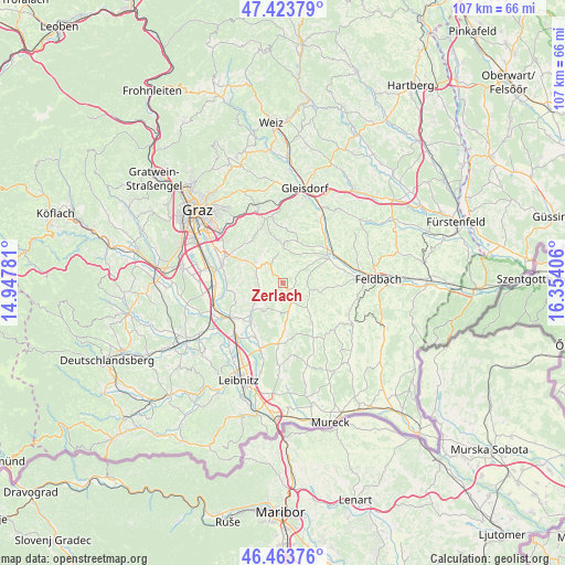
Zerlach GPS coordinates[2]
46° 56' 45.348" North, 15° 39' 3.348" East
| Map corner | latitude | longitude |
|---|---|---|
| Upper-left | 47.42379°, | 14.94781° |
| Center: | 46.94593°, | 15.65093° |
| Lower-right: | 46.46376°, | 16.35406° |
| Map W x H: | 106.7×106.7 km | = 66.3×66.3mi |
| max Lat: | 48.98333° ⇑86.5% North |
| Zerlach: | 46.94593° |
| min Lat: | ⇓13.5% South 46.48841° |
| min Long | Zerlach | max Long |
| 9.57802° | 15.65093° | 17.1° |
| W 70.6%⇐ | ⇒29.4% E |
Elevation
Elevation of Zerlach is 336 m = 1102 ft, and this is 169.5 m = 556 ft below average elevation for this country.
| Max E: |
2140 m = 7021 ft | 68.6% |
| Avg. | 505.5 m = 1658 ft | |
| Zerlach | 336 m = 1102 ft | |
Min E: |
118 m = 387 ft | 31.4% |
See also: Austria elevation on elevation.city.
Geographical zone
Zerlach is located in North temperate zone (between Tropic of Cancer and the Arctic Circle). Distance of this North polar circle is 2181.3 km =1355.4 mi to North.| Distance of | km | miles | from Zerlach |
|---|---|---|---|
| North Pole | 4787.2 | 2974.6 | to North |
| Arctic Circle | 2181.3 | 1355.4 | to North |
| Tropic Cancer | 2614 | 1624.3 | to South |
| Equator | 5219.9 | 3243.5 | to South |


Nearby cities:
15 places around Zerlach: (largest is in red/bold)
• Allerheiligen bei Wildon
8.1 km =5 mi,  244°
244°
• Edelstauden
4.9 km =3 mi,  327°
327°
• Empersdorf
7.1 km =4.4 mi, 326°
• Felgitsch
5.6 km =3.5 mi,  258°
258°
• Frannach
3.9 km =2.4 mi,  199°
199°
• Heiligenkreuz am Waasen
4.9 km =3 mi,  282°
282°
• Kirchbach in Steiermark
1.8 km =1.1 mi,  152°
152°
• Liebensdorf
7.5 km =4.7 mi,  302°
302°
• Mitterlabill
6.4 km =4 mi,  190°
190°
• Oberdorf am Hochegg
6.5 km =4 mi,  55°
55°
• Petersdorf II
6.1 km =3.8 mi,  22°
22°
• Pirching am Traubenberg
3.9 km =2.4 mi, 276°
• Sankt Marein bei Graz
8.2 km =5.1 mi, 17°
• Sankt Stefan im Rosental
6.5 km =4 mi,  136°
136°
• Schwarzau im Schwarzautal
7.5 km =4.7 mi,  172°
172°
Sources, notices
• [Note1] Compared only with cities in Austria existing in our database
• [Src1] Map data: © OpenStreetMap contributors (CC-BY-SA)
• [Src2] Other city data from geonames.org with taken over terms of usage.
• [Src3] Geographical zone / Annual Mean Temperature by Robert A. Rohde @ Wikipedia
