Felgitsch geodata
Felgitsch (Styria) is a populated place; located in Austria in Europe/Vienna (GMT+2) time zone. With population of 531 people, there are 2394 cities with bigger population in this country. Compared to other cities in Austria, 87% of cities are located further ↑North; 67.9% of cities are located further ←West and 64.7% of cities have higher elevation than Felgitsch. Note1
Administrative division(s):
- Level 1: Styria
- Level 2: Politischer Bezirk Leibnitz
- Level 3: Heiligenkreuz am Waasen


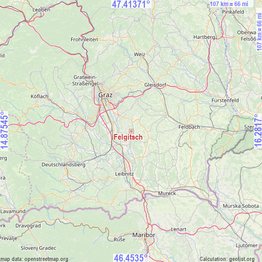
Felgitsch GPS coordinates[2]
46° 56' 8.736" North, 15° 34' 42.852" East
| Map corner | latitude | longitude |
|---|---|---|
| Upper-left | 47.41371°, | 14.87545° |
| Center: | 46.93576°, | 15.57857° |
| Lower-right: | 46.4535°, | 16.2817° |
| Map W x H: | 106.8×106.8 km | = 66.4×66.4mi |
| max Lat: | 48.98333° ⇑87% North |
| Felgitsch: | 46.93576° |
| min Lat: | ⇓13% South 46.48841° |
| min Long | Felgitsch | max Long |
| 9.57802° | 15.57857° | 17.1° |
| W 67.9%⇐ | ⇒32.1% E |
Elevation
Elevation of Felgitsch is 355 m = 1165 ft, and this is 150.5 m = 494 ft below average elevation for this country.
| Max E: |
2140 m = 7021 ft | 64.7% |
| Avg. | 505.5 m = 1658 ft | |
| Felgitsch | 355 m = 1165 ft | |
Min E: |
118 m = 387 ft | 35.3% |
See also: Austria elevation on elevation.city.
Geographical zone
Felgitsch is located in North temperate zone (between Tropic of Cancer and the Arctic Circle). Distance of this North polar circle is 2182.4 km =1356.1 mi to North.| Distance of | km | miles | from Felgitsch |
|---|---|---|---|
| North Pole | 4788.3 | 2975.3 | to North |
| Arctic Circle | 2182.4 | 1356.1 | to North |
| Tropic Cancer | 2612.8 | 1623.5 | to South |
| Equator | 5218.8 | 3242.8 | to South |


Nearby cities:
15 places around Felgitsch: (largest is in red/bold)
• Allerheiligen bei Wildon
3 km =1.9 mi,  217°
217°
• Edelstauden
6 km =3.7 mi,  28°
28°
• Empersdorf
7.2 km =4.5 mi,  12°
12°
• Frannach
4.9 km =3 mi,  121°
121°
• Grosssulz
6.8 km =4.2 mi,  279°
279°
• Heiligenkreuz am Waasen
2.3 km =1.4 mi,  17°
17°
• Kirchbach in Steiermark
6.3 km =3.9 mi,  94°
94°
• Liebensdorf
5.2 km =3.2 mi,  350°
350°
• Mellach
4.7 km =2.9 mi,  266°
266°
• Mitterlabill
6.8 km =4.2 mi,  140°
140°
• Pirching am Traubenberg
2.3 km =1.4 mi,  45°
45°
• Sankt Georgen an der Stiefing
6.9 km =4.3 mi,  179°
179°
• Sankt Ulrich am Waasen
3.4 km =2.1 mi, 265°
• Werndorf
6.8 km =4.2 mi,  259°
259°
• Zerlach
5.6 km =3.5 mi,  78°
78°
Sources, notices
• [Note1] Compared only with cities in Austria existing in our database
• [Src1] Map data: © OpenStreetMap contributors (CC-BY-SA)
• [Src2] Other city data from geonames.org with taken over terms of usage.
• [Src3] Geographical zone / Annual Mean Temperature by Robert A. Rohde @ Wikipedia
