Wolfsegg am Hausruck geodata
Wolfsegg am Hausruck (Upper Austria) is a seat of a third-order administrative division; located in Austria in Europe/Vienna (GMT+2) time zone. With population of 995 people, there are 1298 cities with bigger population in this country. Compared to other cities in Austria, 73% of cities are located further ↓South; 71.8% of cities are located further →East and 73.6% of cities have lower elevation than Wolfsegg am Hausruck. Note1
Administrative division(s):
- Level 1: Upper Austria
- Level 2: Politischer Bezirk Vöcklabruck
- Level 3: Wolfsegg am Hausruck


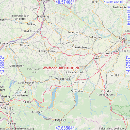
Wolfsegg am Hausruck GPS coordinates[2]
48° 6' 24.084" North, 13° 40' 21.864" East
| Map corner | latitude | longitude |
|---|---|---|
| Upper-left | 48.57406°, | 12.96962° |
| Center: | 48.10669°, | 13.67274° |
| Lower-right: | 47.63504°, | 14.37587° |
| Map W x H: | 104.4×104.4 km | = 64.9×64.9mi |
| max Lat: | 48.98333° ⇑27% North |
| Wolfsegg am Hausruck: | 48.10669° |
| min Lat: | ⇓73% South 46.48841° |
| min Long | Wolfsegg am Hau | max Long |
| 9.57802° | 13.67274° | 17.1° |
| W 28.2%⇐ | ⇒71.8% E |
Elevation
Elevation of Wolfsegg am Hausruck is 633 m = 2077 ft, and this is 127.5 m = 418 ft above average elevation for this country.
| Max E: |
2140 m = 7021 ft | 26.4% |
| Wolfsegg am Hausruck | 633 m 2077 ft | |
| Avg. | 505.5 m = 1658 ft | |
Min E: |
118 m = 387 ft | 73.6% |
See also: Austria elevation on elevation.city.
Geographical zone
Wolfsegg am Hausruck is located in North temperate zone (between Tropic of Cancer and the Arctic Circle). Distance of this North polar circle is 2052.2 km =1275.2 mi to North.| Distance of | km | miles | from Wolfsegg am Hausruck |
|---|---|---|---|
| North Pole | 4658.1 | 2894.4 | to North |
| Arctic Circle | 2052.2 | 1275.2 | to North |
| Tropic Cancer | 2743 | 1704.4 | to South |
| Equator | 5349 | 3323.7 | to South |


Nearby cities:
15 places around Wolfsegg am Hausruck: (largest is in red/bold)
• Altenhof am Hausruck
3.1 km =1.9 mi,  14°
14°
• Ampflwang
8.3 km =5.2 mi,  251°
251°
• Atzbach
3.4 km =2.1 mi,  138°
138°
• Gaspoltshofen
6.2 km =3.9 mi,  49°
49°
• Geboltskirchen
5.9 km =3.7 mi,  330°
330°
• Manning
2.1 km =1.3 mi,  192°
192°
• Niederthalheim
7.2 km =4.5 mi,  96°
96°
• Oberndorf bei Schwanenstadt
8.4 km =5.2 mi,  132°
132°
• Ottnang am Hausruck
1.6 km =1 mi,  220°
220°
• Pitzenberg
5.3 km =3.3 mi, 133°
• Rutzenham
6.1 km =3.8 mi,  146°
146°
• Siedlung
8.6 km =5.3 mi, 252°
• Ungenach
7.9 km =4.9 mi,  213°
213°
• Weibern
8.8 km =5.5 mi, 13°
• Zell am Pettenfirst
6.2 km =3.9 mi,  241°
241°
Sources, notices
• [Note1] Compared only with cities in Austria existing in our database
• [Src1] Map data: © OpenStreetMap contributors (CC-BY-SA)
• [Src2] Other city data from geonames.org with taken over terms of usage.
• [Src3] Geographical zone / Annual Mean Temperature by Robert A. Rohde @ Wikipedia
