Ungenach geodata
Ungenach (Upper Austria) is a seat of a third-order administrative division; located in Austria in Europe/Vienna (GMT+2) time zone. With population of 194 people, there are 2856 cities with bigger population in this country. Compared to other cities in Austria, 69.5% of cities are located further ↓South; 73.3% of cities are located further →East and 55.4% of cities have lower elevation than Ungenach. Note1
Administrative division(s):
- Level 1: Upper Austria
- Level 2: Politischer Bezirk Vöcklabruck
- Level 3: Ungenach


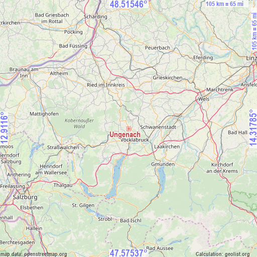
Ungenach GPS coordinates[2]
48° 2' 51.216" North, 13° 36' 52.992" East
| Map corner | latitude | longitude |
|---|---|---|
| Upper-left | 48.51546°, | 12.9116° |
| Center: | 48.04756°, | 13.61472° |
| Lower-right: | 47.57537°, | 14.31785° |
| Map W x H: | 104.5×104.5 km | = 64.9×64.9mi |
| max Lat: | 48.98333° ⇑30.5% North |
| Ungenach: | 48.04756° |
| min Lat: | ⇓69.5% South 46.48841° |
| min Long | Ungenach | max Long |
| 9.57802° | 13.61472° | 17.1° |
| W 26.7%⇐ | ⇒73.3% E |
Elevation
Elevation of Ungenach is 488 m = 1601 ft, and this is 17.5 m = 57 ft below average elevation for this country.
| Max E: |
2140 m = 7021 ft | 44.6% |
| Avg. | 505.5 m = 1658 ft | |
| Ungenach | 488 m = 1601 ft | |
Min E: |
118 m = 387 ft | 55.4% |
See also: Austria elevation on elevation.city.
Geographical zone
Ungenach is located in North temperate zone (between Tropic of Cancer and the Arctic Circle). Distance of this North polar circle is 2058.8 km =1279.3 mi to North.| Distance of | km | miles | from Ungenach |
|---|---|---|---|
| North Pole | 4664.7 | 2898.5 | to North |
| Arctic Circle | 2058.8 | 1279.3 | to North |
| Tropic Cancer | 2736.5 | 1700.4 | to South |
| Equator | 5342.4 | 3319.6 | to South |


Nearby cities:
15 places around Ungenach: (largest is in red/bold)
• Ampflwang
5.3 km =3.3 mi,  318°
318°
• Dörfl
4.9 km =3 mi,  142°
142°
• Dürnau
6 km =3.7 mi,  158°
158°
• Lixlau
6.8 km =4.2 mi,  149°
149°
• Manning
6 km =3.7 mi,  40°
40°
• Neukirchen an der Vöckla
5.8 km =3.6 mi,  262°
262°
• Ottnang am Hausruck
6.3 km =3.9 mi,  31°
31°
• Pichlwang
6.1 km =3.8 mi,  179°
179°
• Puchlkirchen am Trattberg
3.2 km =2 mi, 264°
• Schöndorf
6.1 km =3.8 mi, 147°
• Siedlung
5.6 km =3.5 mi, 315°
• Timelkam
4.9 km =3 mi,  186°
186°
• Vöcklabruck
5.9 km =3.7 mi, 148°
• Wagrain
6.3 km =3.9 mi, 138°
• Zell am Pettenfirst
3.8 km =2.4 mi,  342°
342°
Sources, notices
• [Note1] Compared only with cities in Austria existing in our database
• [Src1] Map data: © OpenStreetMap contributors (CC-BY-SA)
• [Src2] Other city data from geonames.org with taken over terms of usage.
• [Src3] Geographical zone / Annual Mean Temperature by Robert A. Rohde @ Wikipedia
