Ampflwang geodata
Ampflwang (Upper Austria) is a seat of a third-order administrative division; located in Austria in Europe/Vienna (GMT+2) time zone. With population of 1,187 people, there are 1059 cities with bigger population in this country. Compared to other cities in Austria, 71.7% of cities are located further ↓South; 74.1% of cities are located further →East and 63.2% of cities have lower elevation than Ampflwang. Note1
Administrative division(s):
- Level 1: Upper Austria
- Level 2: Politischer Bezirk Vöcklabruck
- Level 3: Ampflwang im Hausruckwald


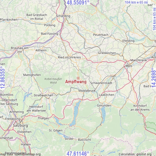
Ampflwang GPS coordinates[2]
48° 4' 59.988" North, 13° 34' 0.012" East
| Map corner | latitude | longitude |
|---|---|---|
| Upper-left | 48.55091°, | 12.86355° |
| Center: | 48.08333°, | 13.56667° |
| Lower-right: | 47.61146°, | 14.2698° |
| Map W x H: | 104.5×104.5 km | = 64.9×64.9mi |
| max Lat: | 48.98333° ⇑28.3% North |
| Ampflwang: | 48.08333° |
| min Lat: | ⇓71.7% South 46.48841° |
| min Long | Ampflwang | max Long |
| 9.57802° | 13.56667° | 17.1° |
| W 25.9%⇐ | ⇒74.1% E |
Elevation
Elevation of Ampflwang is 540 m = 1772 ft, and this is 34.5 m = 113 ft above average elevation for this country.
| Max E: |
2140 m = 7021 ft | 36.8% |
| Ampflwang | 540 m 1772 ft | |
| Avg. | 505.5 m = 1658 ft | |
Min E: |
118 m = 387 ft | 63.2% |
See also: Austria elevation on elevation.city.
Geographical zone
Ampflwang is located in North temperate zone (between Tropic of Cancer and the Arctic Circle). Distance of this North polar circle is 2054.8 km =1276.8 mi to North.| Distance of | km | miles | from Ampflwang |
|---|---|---|---|
| North Pole | 4660.7 | 2896 | to North |
| Arctic Circle | 2054.8 | 1276.8 | to North |
| Tropic Cancer | 2740.4 | 1702.8 | to South |
| Equator | 5346.4 | 3322.1 | to South |


Nearby cities:
15 places around Ampflwang: (largest is in red/bold)
• Eberschwang
8 km =5 mi,  357°
357°
• Frankenburg
5.9 km =3.7 mi,  253°
253°
• Geboltskirchen
9.2 km =5.7 mi,  32°
32°
• Maierhof
8.1 km =5 mi,  0°
0°
• Manning
7.5 km =4.7 mi,  85°
85°
• Neukirchen an der Vöckla
5.2 km =3.2 mi,  204°
204°
• Ottnang am Hausruck
7 km =4.3 mi,  78°
78°
• Pramet
8.9 km =5.5 mi,  318°
318°
• Puchlkirchen am Trattberg
4.3 km =2.7 mi,  174°
174°
• Redleiten
7.3 km =4.5 mi,  268°
268°
• Siedlung
0.4 km =0.2 mi, 274°
• Timelkam
9.3 km =5.8 mi,  160°
160°
• Ungenach
5.3 km =3.3 mi,  138°
138°
• Wolfsegg am Hausruck
8.3 km =5.2 mi,  71°
71°
• Zell am Pettenfirst
2.5 km =1.6 mi,  98°
98°
Sources, notices
• [Note1] Compared only with cities in Austria existing in our database
• [Src1] Map data: © OpenStreetMap contributors (CC-BY-SA)
• [Src2] Other city data from geonames.org with taken over terms of usage.
• [Src3] Geographical zone / Annual Mean Temperature by Robert A. Rohde @ Wikipedia
