Wolfsbach geodata
Wolfsbach (Lower Austria) is a seat of a third-order administrative division; located in Austria in Europe/Vienna (GMT+2) time zone. With population of 2,011 people, there are 612 cities with bigger population in this country. Compared to other cities in Austria, 70.4% of cities are located further ↓South; 50.8% of cities are located further →East and 68.3% of cities have higher elevation than Wolfsbach. Note1
Administrative division(s):
- Level 1: Lower Austria
- Level 2: Politischer Bezirk Amstetten
- Level 3: Wolfsbach


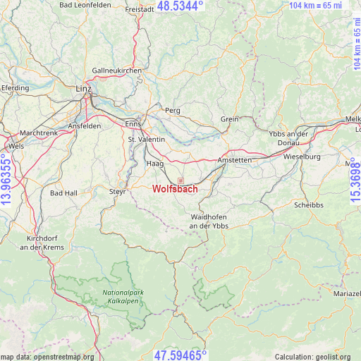
Wolfsbach GPS coordinates[2]
48° 4' 0.012" North, 14° 40' 0.012" East
| Map corner | latitude | longitude |
|---|---|---|
| Upper-left | 48.5344°, | 13.96355° |
| Center: | 48.06667°, | 14.66667° |
| Lower-right: | 47.59465°, | 15.3698° |
| Map W x H: | 104.5×104.5 km | = 64.9×64.9mi |
| max Lat: | 48.98333° ⇑29.6% North |
| Wolfsbach: | 48.06667° |
| min Lat: | ⇓70.4% South 46.48841° |
| min Long | Wolfsbach | max Long |
| 9.57802° | 14.66667° | 17.1° |
| W 49.2%⇐ | ⇒50.8% E |
Elevation
Elevation of Wolfsbach is 337 m = 1106 ft, and this is 168.5 m = 553 ft below average elevation for this country.
| Max E: |
2140 m = 7021 ft | 68.3% |
| Avg. | 505.5 m = 1658 ft | |
| Wolfsbach | 337 m = 1106 ft | |
Min E: |
118 m = 387 ft | 31.7% |
See also: Austria elevation on elevation.city.
Geographical zone
Wolfsbach is located in North temperate zone (between Tropic of Cancer and the Arctic Circle). Distance of this North polar circle is 2056.7 km =1278 mi to North.| Distance of | km | miles | from Wolfsbach |
|---|---|---|---|
| North Pole | 4662.5 | 2897.1 | to North |
| Arctic Circle | 2056.7 | 1278 | to North |
| Tropic Cancer | 2738.6 | 1701.7 | to South |
| Equator | 5344.5 | 3320.9 | to South |


Nearby cities:
15 places around Wolfsbach: (largest is in red/bold)
• Aschbach Markt
6.5 km =4 mi,  84°
84°
• Biberbach
5.1 km =3.2 mi,  142°
142°
• Haag
9 km =5.6 mi,  305°
305°
• Kematen an der Ybbs
8.6 km =5.3 mi,  122°
122°
• Limbach
9.3 km =5.8 mi,  355°
355°
• Mitterhausleiten
4.3 km =2.7 mi,  72°
72°
• Rosenau am Sonntagberg
8.5 km =5.3 mi, 140°
• Sankt Georgen in der Klaus
9.6 km =6 mi,  165°
165°
• Sankt Johann in Engstetten
3.8 km =2.4 mi,  282°
282°
• Sankt Michael am Bruckbach
7.4 km =4.6 mi,  221°
221°
• Sankt Peter in der Au Dorf
2.4 km =1.5 mi,  233°
233°
• Sankt Peter in der Au Markt
4.2 km =2.6 mi, 232°
• Seitenstetten Markt
3.9 km =2.4 mi,  198°
198°
• Strengberg
9 km =5.6 mi,  352°
352°
• Weistrach
6.5 km =4 mi,  253°
253°
Sources, notices
• [Note1] Compared only with cities in Austria existing in our database
• [Src1] Map data: © OpenStreetMap contributors (CC-BY-SA)
• [Src2] Other city data from geonames.org with taken over terms of usage.
• [Src3] Geographical zone / Annual Mean Temperature by Robert A. Rohde @ Wikipedia
