Weistrach geodata
Weistrach (Lower Austria) is a seat of a third-order administrative division; located in Austria in Europe/Vienna (GMT+2) time zone. With population of 2,216 people, there are 549 cities with bigger population in this country. Compared to other cities in Austria, 69.6% of cities are located further ↓South; 52% of cities are located further →East and 64.5% of cities have higher elevation than Weistrach. Note1
Administrative division(s):
- Level 1: Lower Austria
- Level 2: Politischer Bezirk Amstetten
- Level 3: Weistrach


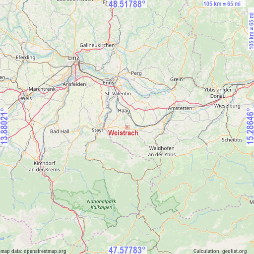
Weistrach GPS coordinates[2]
48° 3' 0" North, 14° 34' 59.988" East
| Map corner | latitude | longitude |
|---|---|---|
| Upper-left | 48.51788°, | 13.88021° |
| Center: | 48.05°, | 14.58333° |
| Lower-right: | 47.57783°, | 15.28646° |
| Map W x H: | 104.5×104.5 km | = 64.9×64.9mi |
| max Lat: | 48.98333° ⇑30.4% North |
| Weistrach: | 48.05° |
| min Lat: | ⇓69.6% South 46.48841° |
| min Long | Weistrach | max Long |
| 9.57802° | 14.58333° | 17.1° |
| W 48%⇐ | ⇒52% E |
Elevation
Elevation of Weistrach is 356 m = 1168 ft, and this is 149.5 m = 490 ft below average elevation for this country.
| Max E: |
2140 m = 7021 ft | 64.5% |
| Avg. | 505.5 m = 1658 ft | |
| Weistrach | 356 m = 1168 ft | |
Min E: |
118 m = 387 ft | 35.5% |
See also: Austria elevation on elevation.city.
Geographical zone
Weistrach is located in North temperate zone (between Tropic of Cancer and the Arctic Circle). Distance of this North polar circle is 2058.5 km =1279.1 mi to North.| Distance of | km | miles | from Weistrach |
|---|---|---|---|
| North Pole | 4664.4 | 2898.3 | to North |
| Arctic Circle | 2058.5 | 1279.1 | to North |
| Tropic Cancer | 2736.7 | 1700.5 | to South |
| Equator | 5342.7 | 3319.8 | to South |


Nearby cities:
15 places around Weistrach: (largest is in red/bold)
• Behamberg
8.3 km =5.2 mi,  243°
243°
• Edelhof
7.7 km =4.8 mi,  346°
346°
• Ertl
8.9 km =5.5 mi,  156°
156°
• Haag
7.2 km =4.5 mi, 350°
• Kleinraming
9.3 km =5.8 mi,  233°
233°
• Kürnberg
6.7 km =4.2 mi,  213°
213°
• Penz
7.7 km =4.8 mi,  255°
255°
• Sankt Johann in Engstetten
3.6 km =2.2 mi,  43°
43°
• Sankt Michael am Bruckbach
3.9 km =2.4 mi, 161°
• Sankt Peter in der Au Dorf
4.3 km =2.7 mi,  84°
84°
• Sankt Peter in der Au Markt
2.9 km =1.8 mi,  103°
103°
• Seitenstetten Markt
5.3 km =3.3 mi,  110°
110°
• Unterwald
9.4 km =5.8 mi,  246°
246°
• Wanzenöd
7.9 km =4.9 mi,  270°
270°
• Wolfsbach
6.5 km =4 mi,  73°
73°
Sources, notices
• [Note1] Compared only with cities in Austria existing in our database
• [Src1] Map data: © OpenStreetMap contributors (CC-BY-SA)
• [Src2] Other city data from geonames.org with taken over terms of usage.
• [Src3] Geographical zone / Annual Mean Temperature by Robert A. Rohde @ Wikipedia
