Limbach geodata
Limbach (Lower Austria) is a populated place; located in Austria in Europe/Vienna (GMT+2) time zone. With population of 519 people, there are 2436 cities with bigger population in this country. Compared to other cities in Austria, 75.5% of cities are located further ↓South; 50.8% of cities are located further →East and 75.9% of cities have higher elevation than Limbach. Note1
Administrative division(s):
- Level 1: Lower Austria
- Level 2: Politischer Bezirk Amstetten
- Level 3: Strengberg


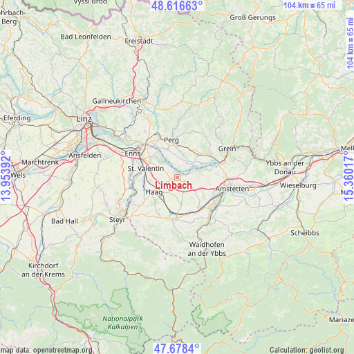
Limbach GPS coordinates[2]
48° 8' 58.776" North, 14° 39' 25.344" East
| Map corner | latitude | longitude |
|---|---|---|
| Upper-left | 48.61663°, | 13.95392° |
| Center: | 48.14966°, | 14.65704° |
| Lower-right: | 47.6784°, | 15.36017° |
| Map W x H: | 104.3×104.3 km | = 64.8×64.8mi |
| max Lat: | 48.98333° ⇑24.5% North |
| Limbach: | 48.14966° |
| min Lat: | ⇓75.5% South 46.48841° |
| min Long | Limbach | max Long |
| 9.57802° | 14.65704° | 17.1° |
| W 49.2%⇐ | ⇒50.8% E |
Elevation
Elevation of Limbach is 297 m = 974 ft, and this is 208.5 m = 684 ft below average elevation for this country.
| Max E: |
2140 m = 7021 ft | 75.9% |
| Avg. | 505.5 m = 1658 ft | |
| Limbach | 297 m = 974 ft | |
Min E: |
118 m = 387 ft | 24.1% |
See also: Austria elevation on elevation.city.
Geographical zone
Limbach is located in North temperate zone (between Tropic of Cancer and the Arctic Circle). Distance of this North polar circle is 2047.4 km =1272.2 mi to North.| Distance of | km | miles | from Limbach |
|---|---|---|---|
| North Pole | 4653.3 | 2891.4 | to North |
| Arctic Circle | 2047.4 | 1272.2 | to North |
| Tropic Cancer | 2747.8 | 1707.4 | to South |
| Equator | 5353.7 | 3326.6 | to South |


Nearby cities:
15 places around Limbach: (largest is in red/bold)
• Arbing
9.5 km =5.9 mi,  21°
21°
• Au an der Donau
10.4 km =6.5 mi,  328°
328°
• Baumgartenberg
9.2 km =5.7 mi,  44°
44°
• Edelhof
8.1 km =5 mi,  243°
243°
• Erla
8.4 km =5.2 mi,  310°
310°
• Haag
7.8 km =4.8 mi, 238°
• Mitterhausleiten
9.3 km =5.8 mi,  148°
148°
• Mitterkirchen im Machland
5.1 km =3.2 mi,  34°
34°
• Naarn im Machlande
9.2 km =5.7 mi,  336°
336°
• Sankt Johann in Engstetten
8.9 km =5.5 mi,  199°
199°
• Sankt Pantaleon
9.5 km =5.9 mi,  315°
315°
• Sankt Valentin
10.6 km =6.6 mi,  280°
280°
• Strengberg
0.5 km =0.3 mi,  232°
232°
• Wallsee
4.8 km =3 mi,  66°
66°
• Wolfsbach
9.3 km =5.8 mi,  175°
175°
Sources, notices
• [Note1] Compared only with cities in Austria existing in our database
• [Src1] Map data: © OpenStreetMap contributors (CC-BY-SA)
• [Src2] Other city data from geonames.org with taken over terms of usage.
• [Src3] Geographical zone / Annual Mean Temperature by Robert A. Rohde @ Wikipedia
