Wiesen geodata
Wiesen (Burgenland) is a seat of a third-order administrative division; located in Austria in Europe/Vienna (GMT+2) time zone. With population of 2,691 people, there are 434 cities with bigger population in this country. Compared to other cities in Austria, 55.1% of cities are located further ↓South; 89.6% of cities are located further ←West and 73% of cities have higher elevation than Wiesen. Note1
Administrative division(s):
- Level 1: Burgenland
- Level 2: Politischer Bezirk Mattersburg
- Level 3: Wiesen


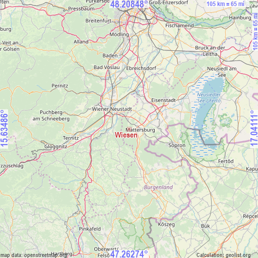
Wiesen GPS coordinates[2]
47° 44' 15.936" North, 16° 20' 16.728" East
| Map corner | latitude | longitude |
|---|---|---|
| Upper-left | 48.20848°, | 15.63486° |
| Center: | 47.73776°, | 16.33798° |
| Lower-right: | 47.26274°, | 17.04111° |
| Map W x H: | 105.2×105.2 km | = 65.4×65.4mi |
| max Lat: | 48.98333° ⇑44.9% North |
| Wiesen: | 47.73776° |
| min Lat: | ⇓55.1% South 46.48841° |
| min Long | Wiesen | max Long |
| 9.57802° | 16.33798° | 17.1° |
| W 89.6%⇐ | ⇒10.4% E |
Elevation
Elevation of Wiesen is 314 m = 1030 ft, and this is 191.5 m = 628 ft below average elevation for this country.
| Max E: |
2140 m = 7021 ft | 73% |
| Avg. | 505.5 m = 1658 ft | |
| Wiesen | 314 m = 1030 ft | |
Min E: |
118 m = 387 ft | 27% |
See also: Austria elevation on elevation.city.
Geographical zone
Wiesen is located in North temperate zone (between Tropic of Cancer and the Arctic Circle). Distance of this North polar circle is 2093.2 km =1300.7 mi to North.| Distance of | km | miles | from Wiesen |
|---|---|---|---|
| North Pole | 4699.1 | 2919.9 | to North |
| Arctic Circle | 2093.2 | 1300.7 | to North |
| Tropic Cancer | 2702 | 1678.9 | to South |
| Equator | 5307.9 | 3298.2 | to South |


Nearby cities:
15 places around Wiesen: (largest is in red/bold)
• Bad Sauerbrunn
4.1 km =2.5 mi,  350°
350°
• Forchtenstein
3 km =1.9 mi,  169°
169°
• Frohsdorf
6.6 km =4.1 mi,  265°
265°
• Haderswörth
6.6 km =4.1 mi, 265°
• Katzelsdorf
7 km =4.3 mi,  313°
313°
• Kleinwolkersdorf
6.7 km =4.2 mi,  281°
281°
• Krensdorf
7.8 km =4.8 mi,  47°
47°
• Marz
6.3 km =3.9 mi,  111°
111°
• Mattersburg
4.7 km =2.9 mi,  96°
96°
• Neudörfl
7.2 km =4.5 mi,  335°
335°
• Pöttelsdorf
7.7 km =4.8 mi,  76°
76°
• Pöttsching
7.8 km =4.8 mi,  18°
18°
• Rohrbach bei Mattersburg
7.8 km =4.8 mi,  117°
117°
• Sigless
6 km =3.7 mi, 45°
• Walbersdorf
6.2 km =3.9 mi,  85°
85°
Sources, notices
• [Note1] Compared only with cities in Austria existing in our database
• [Src1] Map data: © OpenStreetMap contributors (CC-BY-SA)
• [Src2] Other city data from geonames.org with taken over terms of usage.
• [Src3] Geographical zone / Annual Mean Temperature by Robert A. Rohde @ Wikipedia
