Walbersdorf geodata
Walbersdorf (Burgenland) is a populated place; located in Austria in Europe/Vienna (GMT+2) time zone. With population of 772 people, there are 1672 cities with bigger population in this country. Compared to other cities in Austria, 55.3% of cities are located further ↓South; 92% of cities are located further ←West and 89% of cities have higher elevation than Walbersdorf. Note1
Administrative division(s):
- Level 1: Burgenland
- Level 2: Politischer Bezirk Mattersburg
- Level 3: Mattersburg


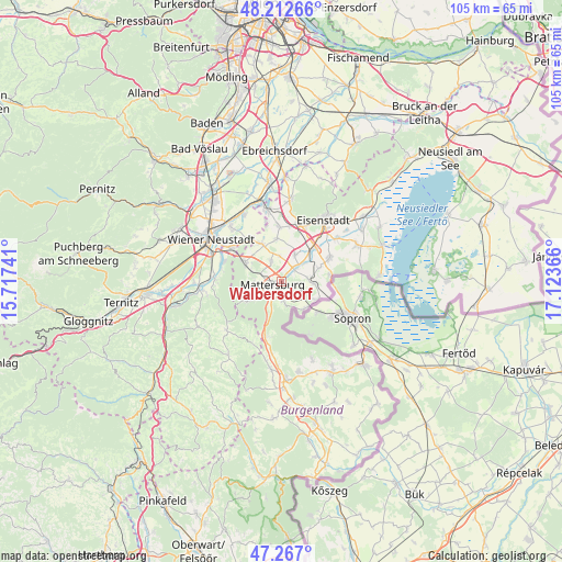
Walbersdorf GPS coordinates[2]
47° 44' 31.128" North, 16° 25' 13.908" East
| Map corner | latitude | longitude |
|---|---|---|
| Upper-left | 48.21266°, | 15.71741° |
| Center: | 47.74198°, | 16.42053° |
| Lower-right: | 47.267°, | 17.12366° |
| Map W x H: | 105.1×105.1 km | = 65.3×65.3mi |
| max Lat: | 48.98333° ⇑44.7% North |
| Walbersdorf: | 47.74198° |
| min Lat: | ⇓55.3% South 46.48841° |
| min Long | Walbersdorf | max Long |
| 9.57802° | 16.42053° | 17.1° |
| W 92%⇐ | ⇒8% E |
Elevation
Elevation of Walbersdorf is 221 m = 725 ft, and this is 284.5 m = 933 ft below average elevation for this country.
| Max E: |
2140 m = 7021 ft | 89% |
| Avg. | 505.5 m = 1658 ft | |
| Walbersdorf | 221 m = 725 ft | |
Min E: |
118 m = 387 ft | 11% |
See also: Austria elevation on elevation.city.
Geographical zone
Walbersdorf is located in North temperate zone (between Tropic of Cancer and the Arctic Circle). Distance of this North polar circle is 2092.8 km =1300.4 mi to North.| Distance of | km | miles | from Walbersdorf |
|---|---|---|---|
| North Pole | 4698.7 | 2919.6 | to North |
| Arctic Circle | 2092.8 | 1300.4 | to North |
| Tropic Cancer | 2702.5 | 1679.3 | to South |
| Equator | 5308.4 | 3298.5 | to South |


Nearby cities:
15 places around Walbersdorf: (largest is in red/bold)
• Antau
5.7 km =3.5 mi,  51°
51°
• Baumgarten im Burgenland
6 km =3.7 mi,  93°
93°
• Drassburg
5 km =3.1 mi,  84°
84°
• Forchtenstein
6.6 km =4.1 mi,  239°
239°
• Hirm
5.6 km =3.5 mi,  27°
27°
• Krensdorf
4.9 km =3 mi,  355°
355°
• Loipersbach im Burgenland
6.7 km =4.2 mi,  139°
139°
• Marz
2.8 km =1.7 mi,  185°
185°
• Mattersburg
1.8 km =1.1 mi, 237°
• Pöttelsdorf
1.9 km =1.2 mi, 46°
• Rohrbach bei Mattersburg
4.2 km =2.6 mi,  170°
170°
• Sigless
4.2 km =2.6 mi,  332°
332°
• Stöttera
4.2 km =2.6 mi, 46°
• Wiesen
6.2 km =3.9 mi,  265°
265°
• Zemendorf
3.2 km =2 mi,  44°
44°
Sources, notices
• [Note1] Compared only with cities in Austria existing in our database
• [Src1] Map data: © OpenStreetMap contributors (CC-BY-SA)
• [Src2] Other city data from geonames.org with taken over terms of usage.
• [Src3] Geographical zone / Annual Mean Temperature by Robert A. Rohde @ Wikipedia
