Forchtenstein geodata
Forchtenstein (Burgenland) is a populated place; located in Austria in Europe/Vienna (GMT+2) time zone. With population of 2,796 people, there are 413 cities with bigger population in this country. Compared to other cities in Austria, 53.9% of cities are located further ↓South; 89.7% of cities are located further ←West and 66.2% of cities have higher elevation than Forchtenstein. Note1
Administrative division(s):
- Level 1: Burgenland
- Level 2: Politischer Bezirk Mattersburg
- Level 3: Forchtenstein


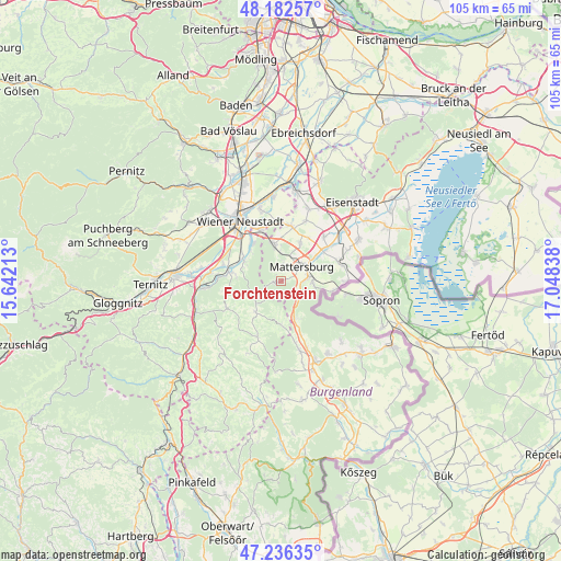
Forchtenstein GPS coordinates[2]
47° 42' 41.796" North, 16° 20' 42.9" East
| Map corner | latitude | longitude |
|---|---|---|
| Upper-left | 48.18257°, | 15.64213° |
| Center: | 47.71161°, | 16.34525° |
| Lower-right: | 47.23635°, | 17.04838° |
| Map W x H: | 105.2×105.2 km | = 65.4×65.4mi |
| max Lat: | 48.98333° ⇑46.1% North |
| Forchtenstein: | 47.71161° |
| min Lat: | ⇓53.9% South 46.48841° |
| min Long | Forchtenstein | max Long |
| 9.57802° | 16.34525° | 17.1° |
| W 89.7%⇐ | ⇒10.3% E |
Elevation
Elevation of Forchtenstein is 347 m = 1138 ft, and this is 158.5 m = 520 ft below average elevation for this country.
| Max E: |
2140 m = 7021 ft | 66.2% |
| Avg. | 505.5 m = 1658 ft | |
| Forchtenstein | 347 m = 1138 ft | |
Min E: |
118 m = 387 ft | 33.8% |
See also: Austria elevation on elevation.city.
Geographical zone
Forchtenstein is located in North temperate zone (between Tropic of Cancer and the Arctic Circle). Distance of this North polar circle is 2096.1 km =1302.5 mi to North.| Distance of | km | miles | from Forchtenstein |
|---|---|---|---|
| North Pole | 4702 | 2921.7 | to North |
| Arctic Circle | 2096.1 | 1302.5 | to North |
| Tropic Cancer | 2699.1 | 1677.1 | to South |
| Equator | 5305 | 3296.4 | to South |


Nearby cities:
15 places around Forchtenstein: (largest is in red/bold)
• Bad Sauerbrunn
7.1 km =4.4 mi,  349°
349°
• Frohsdorf
7.5 km =4.7 mi,  288°
288°
• Haderswörth
7.5 km =4.7 mi, 288°
• Hochwolkersdorf
7.4 km =4.6 mi,  220°
220°
• Kleinwolkersdorf
8.3 km =5.2 mi,  300°
300°
• Marz
5.4 km =3.4 mi,  83°
83°
• Mattersburg
4.8 km =3 mi,  59°
59°
• Pöttelsdorf
8.4 km =5.2 mi, 56°
• Rohrbach bei Mattersburg
6.4 km =4 mi,  96°
96°
• Schwarzenbach
8.5 km =5.3 mi,  177°
177°
• Sieggraben
7.2 km =4.5 mi,  158°
158°
• Sigless
8 km =5 mi,  27°
27°
• Walbersdorf
6.6 km =4.1 mi, 59°
• Walpersbach
8.4 km =5.2 mi,  273°
273°
• Wiesen
3 km =1.9 mi, 349°
Sources, notices
• [Note1] Compared only with cities in Austria existing in our database
• [Src1] Map data: © OpenStreetMap contributors (CC-BY-SA)
• [Src2] Other city data from geonames.org with taken over terms of usage.
• [Src3] Geographical zone / Annual Mean Temperature by Robert A. Rohde @ Wikipedia
