Katzelsdorf geodata
Katzelsdorf (Lower Austria) is a seat of a third-order administrative division; located in Austria in Europe/Vienna (GMT+2) time zone. With population of 3,112 people, there are 362 cities with bigger population in this country. Compared to other cities in Austria, 56.4% of cities are located further ↓South; 87.9% of cities are located further ←West and 79.5% of cities have higher elevation than Katzelsdorf. Note1
Administrative division(s):
- Level 1: Lower Austria
- Level 2: Politischer Bezirk Wiener Neustadt
- Level 3: Katzelsdorf


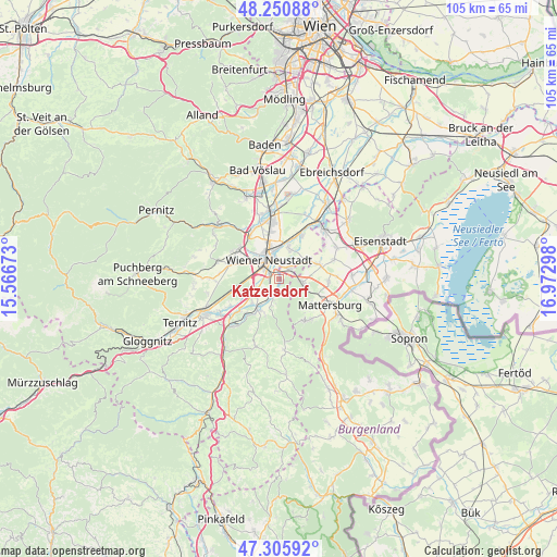
Katzelsdorf GPS coordinates[2]
47° 46' 49.98" North, 16° 16' 11.46" East
| Map corner | latitude | longitude |
|---|---|---|
| Upper-left | 48.25088°, | 15.56673° |
| Center: | 47.78055°, | 16.26985° |
| Lower-right: | 47.30592°, | 16.97298° |
| Map W x H: | 105.1×105.1 km | = 65.3×65.3mi |
| max Lat: | 48.98333° ⇑43.6% North |
| Katzelsdorf: | 47.78055° |
| min Lat: | ⇓56.4% South 46.48841° |
| min Long | Katzelsdorf | max Long |
| 9.57802° | 16.26985° | 17.1° |
| W 87.9%⇐ | ⇒12.1% E |
Elevation
Elevation of Katzelsdorf is 277 m = 909 ft, and this is 228.5 m = 750 ft below average elevation for this country.
| Max E: |
2140 m = 7021 ft | 79.5% |
| Avg. | 505.5 m = 1658 ft | |
| Katzelsdorf | 277 m = 909 ft | |
Min E: |
118 m = 387 ft | 20.5% |
See also: Austria elevation on elevation.city.
Geographical zone
Katzelsdorf is located in North temperate zone (between Tropic of Cancer and the Arctic Circle). Distance of this North polar circle is 2088.5 km =1297.7 mi to North.| Distance of | km | miles | from Katzelsdorf |
|---|---|---|---|
| North Pole | 4694.4 | 2917 | to North |
| Arctic Circle | 2088.5 | 1297.7 | to North |
| Tropic Cancer | 2706.8 | 1681.9 | to South |
| Equator | 5312.7 | 3301.2 | to South |


Nearby cities:
15 places around Katzelsdorf: (largest is in red/bold)
• Bad Erlach
7.2 km =4.5 mi,  214°
214°
• Bad Sauerbrunn
4.4 km =2.7 mi,  98°
98°
• Frohsdorf
5.5 km =3.4 mi,  195°
195°
• Haderswörth
5.5 km =3.4 mi, 195°
• Kleinwolkersdorf
3.7 km =2.3 mi, 203°
• Lanzenkirchen
6.2 km =3.9 mi,  217°
217°
• Lichtenwörth
5.7 km =3.5 mi,  22°
22°
• Neudörfl
2.7 km =1.7 mi,  49°
49°
• Pöttsching
8 km =5 mi,  70°
70°
• Schwarzau am Steinfeld
9.2 km =5.7 mi,  233°
233°
• Theresienfeld
8.2 km =5.1 mi,  340°
340°
• Walpersbach
7.6 km =4.7 mi, 201°
• Wiener Neustadt
3.9 km =2.4 mi,  313°
313°
• Wiesen
7 km =4.3 mi,  133°
133°
• Zillingdorf
9.1 km =5.7 mi,  31°
31°
Sources, notices
• [Note1] Compared only with cities in Austria existing in our database
• [Src1] Map data: © OpenStreetMap contributors (CC-BY-SA)
• [Src2] Other city data from geonames.org with taken over terms of usage.
• [Src3] Geographical zone / Annual Mean Temperature by Robert A. Rohde @ Wikipedia
