Westendorf geodata
Westendorf (Tyrol) is a seat of a third-order administrative division; located in Austria in Europe/Vienna (GMT+2) time zone. With population of 3,652 people, there are 293 cities with bigger population in this country. Compared to other cities in Austria, 57.6% of cities are located further ↑North; 87.5% of cities are located further →East and 84% of cities have lower elevation than Westendorf. Note1
Administrative division(s):
- Level 1: Tyrol
- Level 2: Politischer Bezirk Kitzbühel
- Level 3: Westendorf


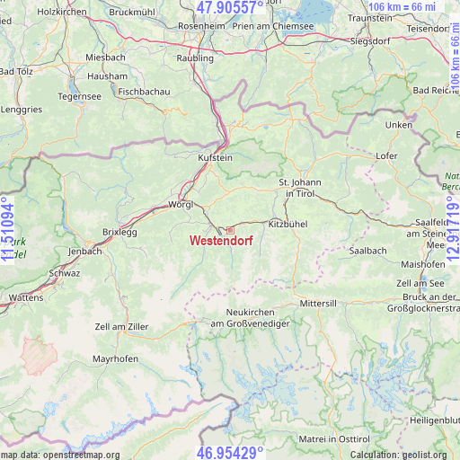
Westendorf GPS coordinates[2]
47° 25' 55.488" North, 12° 12' 50.616" East
| Map corner | latitude | longitude |
|---|---|---|
| Upper-left | 47.90557°, | 11.51094° |
| Center: | 47.43208°, | 12.21406° |
| Lower-right: | 46.95429°, | 12.91719° |
| Map W x H: | 105.8×105.8 km | = 65.7×65.7mi |
| max Lat: | 48.98333° ⇑57.6% North |
| Westendorf: | 47.43208° |
| min Lat: | ⇓42.4% South 46.48841° |
| min Long | Westendorf | max Long |
| 9.57802° | 12.21406° | 17.1° |
| W 12.5%⇐ | ⇒87.5% E |
Elevation
Elevation of Westendorf is 782 m = 2566 ft, and this is 276.5 m = 907 ft above average elevation for this country.
| Max E: |
2140 m = 7021 ft | 16% |
| Westendorf | 782 m 2566 ft | |
| Avg. | 505.5 m = 1658 ft | |
Min E: |
118 m = 387 ft | 84% |
See also: Austria elevation on elevation.city.
Geographical zone
Westendorf is located in North temperate zone (between Tropic of Cancer and the Arctic Circle). Distance of this North polar circle is 2127.2 km =1321.8 mi to North.| Distance of | km | miles | from Westendorf |
|---|---|---|---|
| North Pole | 4733.1 | 2941 | to North |
| Arctic Circle | 2127.2 | 1321.8 | to North |
| Tropic Cancer | 2668 | 1657.8 | to South |
| Equator | 5274 | 3277.1 | to South |


Nearby cities:
15 places around Westendorf: (largest is in red/bold)
• Bad Häring
11.3 km =7 mi,  320°
320°
• Brixen im Thale
3.4 km =2.1 mi,  53°
53°
• Ellmau
11.1 km =6.9 mi,  35°
35°
• Grafenweg
8.3 km =5.2 mi,  283°
283°
• Hopfgarten im Brixental
4.7 km =2.9 mi,  294°
294°
• Itter
7.2 km =4.5 mi,  302°
302°
• Kelchsau
8.1 km =5 mi,  228°
228°
• Kirchberg in Tirol
7.8 km =4.8 mi,  79°
79°
• Niederau
10 km =6.2 mi, 281°
• Oberau
12.5 km =7.8 mi, 275°
• Penningberg
6.8 km =4.2 mi,  260°
260°
• Reith bei Kitzbühel
10.9 km =6.8 mi,  69°
69°
• Scheffau am Wilden Kaiser
11.2 km =7 mi,  14°
14°
• Sonnseite
12.2 km =7.6 mi, 36°
• Söll
8.1 km =5 mi,  348°
348°
Sources, notices
• [Note1] Compared only with cities in Austria existing in our database
• [Src1] Map data: © OpenStreetMap contributors (CC-BY-SA)
• [Src2] Other city data from geonames.org with taken over terms of usage.
• [Src3] Geographical zone / Annual Mean Temperature by Robert A. Rohde @ Wikipedia
