Niederau geodata
Niederau (Tyrol) is a populated place; located in Austria in Europe/Vienna (GMT+2) time zone. With population of 1,043 people, there are 1226 cities with bigger population in this country. Compared to other cities in Austria, 56.5% of cities are located further ↑North; 88.4% of cities are located further →East and 86.4% of cities have lower elevation than Niederau. Note1
Administrative division(s):
- Level 1: Tyrol
- Level 2: Politischer Bezirk Kufstein
- Level 3: Wildschönau


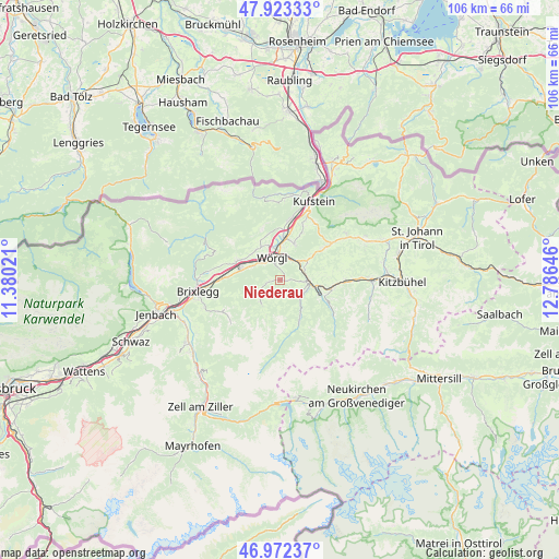
Niederau GPS coordinates[2]
47° 27' 0" North, 12° 4' 59.988" East
| Map corner | latitude | longitude |
|---|---|---|
| Upper-left | 47.92333°, | 11.38021° |
| Center: | 47.45°, | 12.08333° |
| Lower-right: | 46.97237°, | 12.78646° |
| Map W x H: | 105.7×105.7 km | = 65.7×65.7mi |
| max Lat: | 48.98333° ⇑56.5% North |
| Niederau: | 47.45° |
| min Lat: | ⇓43.5% South 46.48841° |
| min Long | Niederau | max Long |
| 9.57802° | 12.08333° | 17.1° |
| W 11.6%⇐ | ⇒88.4% E |
Elevation
Elevation of Niederau is 819 m = 2687 ft, and this is 313.5 m = 1029 ft above average elevation for this country.
| Max E: |
2140 m = 7021 ft | 13.6% |
| Niederau | 819 m 2687 ft | |
| Avg. | 505.5 m = 1658 ft | |
Min E: |
118 m = 387 ft | 86.4% |
See also: Austria elevation on elevation.city.
Geographical zone
Niederau is located in North temperate zone (between Tropic of Cancer and the Arctic Circle). Distance of this North polar circle is 2125.2 km =1320.5 mi to North.| Distance of | km | miles | from Niederau |
|---|---|---|---|
| North Pole | 4731.1 | 2939.8 | to North |
| Arctic Circle | 2125.2 | 1320.5 | to North |
| Tropic Cancer | 2670 | 1659.1 | to South |
| Equator | 5275.9 | 3278.3 | to South |


Nearby cities:
15 places around Niederau: (largest is in red/bold)
• Angath
6.5 km =4 mi,  347°
347°
• Angerberg
7.3 km =4.5 mi,  327°
327°
• Auffach
6.7 km =4.2 mi,  214°
214°
• Bad Häring
7.3 km =4.5 mi,  21°
21°
• Grafenweg
1.8 km =1.1 mi,  90°
90°
• Hopfgarten im Brixental
5.5 km =3.4 mi, 90°
• Itter
4.2 km =2.6 mi,  63°
63°
• Kirchbichl
7.6 km =4.7 mi,  7°
7°
• Kundl
7.7 km =4.8 mi,  283°
283°
• Liesfeld
7.1 km =4.4 mi,  293°
293°
• Oberau
2.7 km =1.7 mi,  254°
254°
• Oberlangkampfen
7.9 km =4.9 mi,  2°
2°
• Penningberg
4.4 km =2.7 mi,  134°
134°
• Wildschönau
6 km =3.7 mi,  215°
215°
• Wörgl
4.6 km =2.9 mi,  339°
339°
Sources, notices
• [Note1] Compared only with cities in Austria existing in our database
• [Src1] Map data: © OpenStreetMap contributors (CC-BY-SA)
• [Src2] Other city data from geonames.org with taken over terms of usage.
• [Src3] Geographical zone / Annual Mean Temperature by Robert A. Rohde @ Wikipedia
