Söll geodata
Söll (Tyrol) is a seat of a third-order administrative division; located in Austria in Europe/Vienna (GMT+2) time zone. With population of 3,631 people, there are 296 cities with bigger population in this country. Compared to other cities in Austria, 53.5% of cities are located further ↑North; 87.5% of cities are located further →East and 78.3% of cities have lower elevation than Söll. Note1


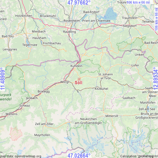
Söll GPS coordinates[2]
47° 30' 13.608" North, 12° 11' 31.956" East
| Map corner | latitude | longitude |
|---|---|---|
| Upper-left | 47.97662°, | 11.48909° |
| Center: | 47.50378°, | 12.19221° |
| Lower-right: | 47.02664°, | 12.89534° |
| Map W x H: | 105.6×105.6 km | = 65.6×65.6mi |
| max Lat: | 48.98333° ⇑53.5% North |
| Söll: | 47.50378° |
| min Lat: | ⇓46.5% South 46.48841° |
| min Long | Söll | max Long |
| 9.57802° | 12.19221° | 17.1° |
| W 12.5%⇐ | ⇒87.5% E |
Elevation
Elevation of Söll is 691 m = 2267 ft, and this is 185.5 m = 609 ft above average elevation for this country.
| Max E: |
2140 m = 7021 ft | 21.7% |
| Söll | 691 m 2267 ft | |
| Avg. | 505.5 m = 1658 ft | |
Min E: |
118 m = 387 ft | 78.3% |
See also: Austria elevation on elevation.city.
Geographical zone
Söll is located in North temperate zone (between Tropic of Cancer and the Arctic Circle). Distance of this North polar circle is 2119.2 km =1316.8 mi to North.| Distance of | km | miles | from Söll |
|---|---|---|---|
| North Pole | 4725.1 | 2936 | to North |
| Arctic Circle | 2119.2 | 1316.8 | to North |
| Tropic Cancer | 2676 | 1662.8 | to South |
| Equator | 5281.9 | 3282 | to South |


Nearby cities:
15 places around Söll: (largest is in red/bold)
• Bad Häring
5.5 km =3.4 mi,  277°
277°
• Brixen im Thale
7.4 km =4.6 mi,  144°
144°
• Ellmau
8.1 km =5 mi,  82°
82°
• Endach
7.6 km =4.7 mi,  339°
339°
• Hopfgarten im Brixental
6.6 km =4.1 mi,  204°
204°
• Itter
6 km =3.7 mi,  226°
226°
• Kirchbichl
7.4 km =4.6 mi, 281°
• Langkampfen
8.5 km =5.3 mi,  306°
306°
• Mitterndorf
8.3 km =5.2 mi,  348°
348°
• Oberlangkampfen
8 km =5 mi, 284°
• Scheffau am Wilden Kaiser
5.3 km =3.3 mi,  57°
57°
• Schwoich
6.1 km =3.8 mi,  320°
320°
• Unterlangkampfen
8.6 km =5.3 mi, 306°
• Weissach
7.8 km =4.8 mi, 343°
• Westendorf
8.1 km =5 mi,  168°
168°
Sources, notices
• [Note1] Compared only with cities in Austria existing in our database
• [Src1] Map data: © OpenStreetMap contributors (CC-BY-SA)
• [Src2] Other city data from geonames.org with taken over terms of usage.
• [Src3] Geographical zone / Annual Mean Temperature by Robert A. Rohde @ Wikipedia
