Brixen im Thale geodata
Brixen im Thale (Tyrol) is a seat of a third-order administrative division; located in Austria in Europe/Vienna (GMT+2) time zone. With population of 2,639 people, there are 444 cities with bigger population in this country. Compared to other cities in Austria, 56.5% of cities are located further ↑North; 87.3% of cities are located further →East and 85.2% of cities have lower elevation than Brixen im Thale. Note1
Administrative division(s):
- Level 1: Tyrol
- Level 2: Politischer Bezirk Kitzbühel
- Level 3: Brixen im Thale


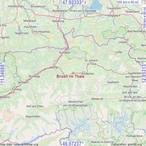
Brixen im Thale GPS coordinates[2]
47° 27' 0" North, 12° 15' 0" East
| Map corner | latitude | longitude |
|---|---|---|
| Upper-left | 47.92333°, | 11.54688° |
| Center: | 47.45°, | 12.25° |
| Lower-right: | 46.97237°, | 12.95313° |
| Map W x H: | 105.7×105.7 km | = 65.7×65.7mi |
| max Lat: | 48.98333° ⇑56.5% North |
| Brixen im Thale: | 47.45° |
| min Lat: | ⇓43.5% South 46.48841° |
| min Long | Brixen im Thale | max Long |
| 9.57802° | 12.25° | 17.1° |
| W 12.7%⇐ | ⇒87.3% E |
Elevation
Elevation of Brixen im Thale is 798 m = 2618 ft, and this is 292.5 m = 960 ft above average elevation for this country.
| Max E: |
2140 m = 7021 ft | 14.8% |
| Brixen im Thale | 798 m 2618 ft | |
| Avg. | 505.5 m = 1658 ft | |
Min E: |
118 m = 387 ft | 85.2% |
See also: Austria elevation on elevation.city.
Geographical zone
Brixen im Thale is located in North temperate zone (between Tropic of Cancer and the Arctic Circle). Distance of this North polar circle is 2125.2 km =1320.5 mi to North.| Distance of | km | miles | from Brixen im Thale |
|---|---|---|---|
| North Pole | 4731.1 | 2939.8 | to North |
| Arctic Circle | 2125.2 | 1320.5 | to North |
| Tropic Cancer | 2670 | 1659.1 | to South |
| Equator | 5275.9 | 3278.3 | to South |


Nearby cities:
15 places around Brixen im Thale: (largest is in red/bold)
• Ellmau
8 km =5 mi,  27°
27°
• Going
9.3 km =5.8 mi,  41°
41°
• Grafenweg
10.7 km =6.6 mi,  269°
269°
• Hopfgarten im Brixental
7 km =4.3 mi, 269°
• Itter
9 km =5.6 mi,  281°
281°
• Kelchsau
11.5 km =7.1 mi,  229°
229°
• Kirchberg in Tirol
5 km =3.1 mi,  95°
95°
• Kitzbühel
10.7 km =6.6 mi,  92°
92°
• Oberndorf in Tirol
11.5 km =7.1 mi,  60°
60°
• Penningberg
9.9 km =6.2 mi,  251°
251°
• Reith bei Kitzbühel
7.7 km =4.8 mi,  76°
76°
• Scheffau am Wilden Kaiser
8.8 km =5.5 mi,  0°
0°
• Sonnseite
9.1 km =5.7 mi, 30°
• Söll
7.4 km =4.6 mi,  324°
324°
• Westendorf
3.4 km =2.1 mi, 233°
Sources, notices
• [Note1] Compared only with cities in Austria existing in our database
• [Src1] Map data: © OpenStreetMap contributors (CC-BY-SA)
• [Src2] Other city data from geonames.org with taken over terms of usage.
• [Src3] Geographical zone / Annual Mean Temperature by Robert A. Rohde @ Wikipedia
