Wernersdorf geodata
Wernersdorf (Styria) is a seat of a third-order administrative division; located in Austria in Europe/Vienna (GMT+2) time zone. With population of 161 people, there are 2889 cities with bigger population in this country. Compared to other cities in Austria, 94.8% of cities are located further ↑North; 57.6% of cities are located further ←West and 59.8% of cities have higher elevation than Wernersdorf. Note1
Administrative division(s):
- Level 1: Styria
- Level 2: Politischer Bezirk Deutschlandsberg
- Level 3: Wies


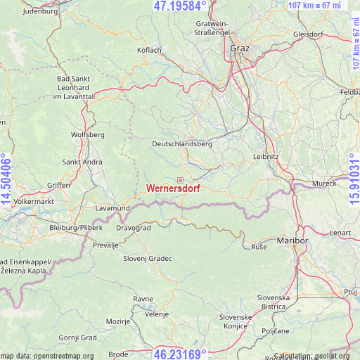
Wernersdorf GPS coordinates[2]
46° 42' 57.312" North, 15° 12' 25.848" East
| Map corner | latitude | longitude |
|---|---|---|
| Upper-left | 47.19584°, | 14.50406° |
| Center: | 46.71592°, | 15.20718° |
| Lower-right: | 46.23169°, | 15.91031° |
| Map W x H: | 107.2×107.2 km | = 66.6×66.6mi |
| max Lat: | 48.98333° ⇑94.8% North |
| Wernersdorf: | 46.71592° |
| min Lat: | ⇓5.2% South 46.48841° |
| min Long | Wernersdorf | max Long |
| 9.57802° | 15.20718° | 17.1° |
| W 57.6%⇐ | ⇒42.4% E |
Elevation
Elevation of Wernersdorf is 383 m = 1257 ft, and this is 122.5 m = 402 ft below average elevation for this country.
| Max E: |
2140 m = 7021 ft | 59.8% |
| Avg. | 505.5 m = 1658 ft | |
| Wernersdorf | 383 m = 1257 ft | |
Min E: |
118 m = 387 ft | 40.2% |
See also: Austria elevation on elevation.city.
Geographical zone
Wernersdorf is located in North temperate zone (between Tropic of Cancer and the Arctic Circle). Distance of this North polar circle is 2206.9 km =1371.3 mi to North.| Distance of | km | miles | from Wernersdorf |
|---|---|---|---|
| North Pole | 4812.7 | 2990.5 | to North |
| Arctic Circle | 2206.9 | 1371.3 | to North |
| Tropic Cancer | 2588.4 | 1608.4 | to South |
| Equator | 5194.3 | 3227.6 | to South |


Nearby cities:
15 places around Wernersdorf: (largest is in red/bold)
• Aibl
4.1 km =2.5 mi,  159°
159°
• Altenmarkt bei Wies
3.3 km =2.1 mi,  88°
88°
• Brunn
7.2 km =4.5 mi,  78°
78°
• Eibiswald
4.5 km =2.8 mi,  136°
136°
• Garanas
8.9 km =5.5 mi,  309°
309°
• Hollenegg
8.4 km =5.2 mi,  3°
3°
• Hörmsdorf
5 km =3.1 mi,  120°
120°
• Mainsdorf
6.4 km =4 mi,  331°
331°
• Mitterlimberg
2.8 km =1.7 mi,  45°
45°
• Pitschgau
4.9 km =3 mi,  111°
111°
• Sankt Martin im Sulmtal
8.2 km =5.1 mi,  56°
56°
• Sankt Oswald ob Eibiswald
4.7 km =2.9 mi,  259°
259°
• Sankt Peter im Sulmtal
5 km =3.1 mi,  40°
40°
• Schwanberg
4.7 km =2.9 mi, 1°
• Wies
5 km =3.1 mi, 84°
Sources, notices
• [Note1] Compared only with cities in Austria existing in our database
• [Src1] Map data: © OpenStreetMap contributors (CC-BY-SA)
• [Src2] Other city data from geonames.org with taken over terms of usage.
• [Src3] Geographical zone / Annual Mean Temperature by Robert A. Rohde @ Wikipedia
