Schwanberg geodata
Schwanberg (Styria) is a seat of a third-order administrative division; located in Austria in Europe/Vienna (GMT+2) time zone. With population of 1,363 people, there are 925 cities with bigger population in this country. Compared to other cities in Austria, 93.1% of cities are located further ↑North; 57.6% of cities are located further ←West and 57.5% of cities have higher elevation than Schwanberg. Note1
Administrative division(s):
- Level 1: Styria
- Level 2: Politischer Bezirk Deutschlandsberg
- Level 3: Schwanberg


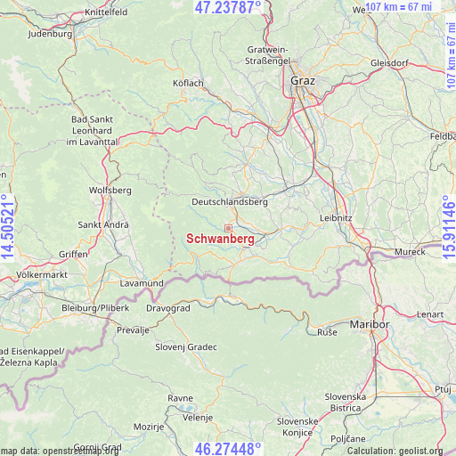
Schwanberg GPS coordinates[2]
46° 45' 29.988" North, 15° 12' 29.988" East
| Map corner | latitude | longitude |
|---|---|---|
| Upper-left | 47.23787°, | 14.50521° |
| Center: | 46.75833°, | 15.20833° |
| Lower-right: | 46.27448°, | 15.91146° |
| Map W x H: | 107.1×107.1 km | = 66.5×66.5mi |
| max Lat: | 48.98333° ⇑93.1% North |
| Schwanberg: | 46.75833° |
| min Lat: | ⇓6.9% South 46.48841° |
| min Long | Schwanberg | max Long |
| 9.57802° | 15.20833° | 17.1° |
| W 57.6%⇐ | ⇒42.4% E |
Elevation
Elevation of Schwanberg is 401 m = 1316 ft, and this is 104.5 m = 343 ft below average elevation for this country.
| Max E: |
2140 m = 7021 ft | 57.5% |
| Avg. | 505.5 m = 1658 ft | |
| Schwanberg | 401 m = 1316 ft | |
Min E: |
118 m = 387 ft | 42.5% |
See also: Austria elevation on elevation.city.
Geographical zone
Schwanberg is located in North temperate zone (between Tropic of Cancer and the Arctic Circle). Distance of this North polar circle is 2202.1 km =1368.3 mi to North.| Distance of | km | miles | from Schwanberg |
|---|---|---|---|
| North Pole | 4808 | 2987.6 | to North |
| Arctic Circle | 2202.1 | 1368.3 | to North |
| Tropic Cancer | 2593.1 | 1611.3 | to South |
| Equator | 5199 | 3230.5 | to South |


Nearby cities:
15 places around Schwanberg: (largest is in red/bold)
• Altenmarkt bei Wies
5.6 km =3.5 mi,  145°
145°
• Brunn
7.7 km =4.8 mi,  114°
114°
• Deutschlandsberg
6.4 km =4 mi,  9°
9°
• Freidorf an der Laßnitz
7.2 km =4.5 mi,  26°
26°
• Garanas
7 km =4.3 mi,  277°
277°
• Hollenegg
3.7 km =2.3 mi, 6°
• Lassnitz
7.2 km =4.5 mi, 26°
• Mainsdorf
3.3 km =2.1 mi,  286°
286°
• Mitterlimberg
3.4 km =2.1 mi, 145°
• Pitschgau
7.9 km =4.9 mi, 145°
• Sankt Martin im Sulmtal
6.8 km =4.2 mi,  92°
92°
• Sankt Oswald ob Eibiswald
7.3 km =4.5 mi,  220°
220°
• Sankt Peter im Sulmtal
3.3 km =2.1 mi, 106°
• Wernersdorf
4.7 km =2.9 mi,  181°
181°
• Wies
6.4 km =4 mi,  131°
131°
Sources, notices
• [Note1] Compared only with cities in Austria existing in our database
• [Src1] Map data: © OpenStreetMap contributors (CC-BY-SA)
• [Src2] Other city data from geonames.org with taken over terms of usage.
• [Src3] Geographical zone / Annual Mean Temperature by Robert A. Rohde @ Wikipedia
