Mainsdorf geodata
Mainsdorf (Styria) is a populated place; located in Austria in Europe/Vienna (GMT+2) time zone. With population of 579 people, there are 2214 cities with bigger population in this country. Compared to other cities in Austria, 93% of cities are located further ↑North; 57% of cities are located further ←West and 75.5% of cities have lower elevation than Mainsdorf. Note1
Administrative division(s):
- Level 1: Styria
- Level 2: Politischer Bezirk Deutschlandsberg
- Level 3: Schwanberg


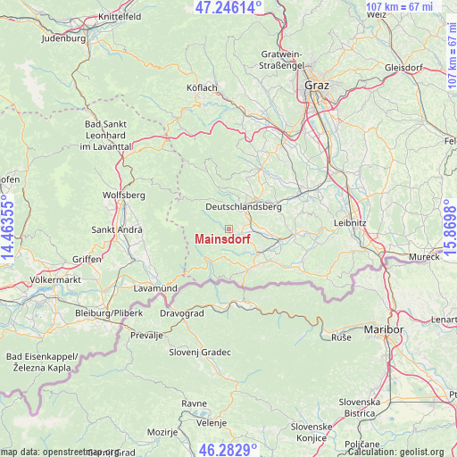
Mainsdorf GPS coordinates[2]
46° 46' 0.012" North, 15° 10' 0.012" East
| Map corner | latitude | longitude |
|---|---|---|
| Upper-left | 47.24614°, | 14.46355° |
| Center: | 46.76667°, | 15.16667° |
| Lower-right: | 46.2829°, | 15.8698° |
| Map W x H: | 107.1×107.1 km | = 66.5×66.5mi |
| max Lat: | 48.98333° ⇑93% North |
| Mainsdorf: | 46.76667° |
| min Lat: | ⇓7% South 46.48841° |
| min Long | Mainsdorf | max Long |
| 9.57802° | 15.16667° | 17.1° |
| W 57%⇐ | ⇒43% E |
Elevation
Elevation of Mainsdorf is 655 m = 2149 ft, and this is 149.5 m = 490 ft above average elevation for this country.
| Max E: |
2140 m = 7021 ft | 24.5% |
| Mainsdorf | 655 m 2149 ft | |
| Avg. | 505.5 m = 1658 ft | |
Min E: |
118 m = 387 ft | 75.5% |
See also: Austria elevation on elevation.city.
Geographical zone
Mainsdorf is located in North temperate zone (between Tropic of Cancer and the Arctic Circle). Distance of this North polar circle is 2201.2 km =1367.8 mi to North.| Distance of | km | miles | from Mainsdorf |
|---|---|---|---|
| North Pole | 4807.1 | 2987 | to North |
| Arctic Circle | 2201.2 | 1367.8 | to North |
| Tropic Cancer | 2594 | 1611.8 | to South |
| Equator | 5200 | 3231.1 | to South |


Nearby cities:
15 places around Mainsdorf: (largest is in red/bold)
• Altenmarkt bei Wies
8.4 km =5.2 mi,  131°
131°
• Deutschlandsberg
6.9 km =4.3 mi,  38°
38°
• Freidorf an der Laßnitz
8.4 km =5.2 mi,  48°
48°
• Freiland bei Deutschlandsberg
7.8 km =4.8 mi,  341°
341°
• Garanas
3.8 km =2.4 mi,  270°
270°
• Gressenberg
5.3 km =3.3 mi,  314°
314°
• Hollenegg
4.5 km =2.8 mi, 52°
• Lassnitz
8.4 km =5.2 mi, 48°
• Mitterlimberg
6.3 km =3.9 mi, 126°
• Sankt Oswald ob Eibiswald
6.7 km =4.2 mi,  193°
193°
• Sankt Peter im Sulmtal
6.6 km =4.1 mi,  106°
106°
• Schwanberg
3.3 km =2.1 mi, 106°
• Trahütten
6.5 km =4 mi,  353°
353°
• Wernersdorf
6.4 km =4 mi,  151°
151°
• Wies
9.5 km =5.9 mi,  122°
122°
Sources, notices
• [Note1] Compared only with cities in Austria existing in our database
• [Src1] Map data: © OpenStreetMap contributors (CC-BY-SA)
• [Src2] Other city data from geonames.org with taken over terms of usage.
• [Src3] Geographical zone / Annual Mean Temperature by Robert A. Rohde @ Wikipedia
