Pitschgau geodata
Pitschgau (Styria) is a seat of a third-order administrative division; located in Austria in Europe/Vienna (GMT+2) time zone. With population of 171 people, there are 2881 cities with bigger population in this country. Compared to other cities in Austria, 95.4% of cities are located further ↑North; 59.2% of cities are located further ←West and 65.5% of cities have higher elevation than Pitschgau. Note1
Administrative division(s):
- Level 1: Styria
- Level 2: Politischer Bezirk Deutschlandsberg
- Level 3: Eibiswald


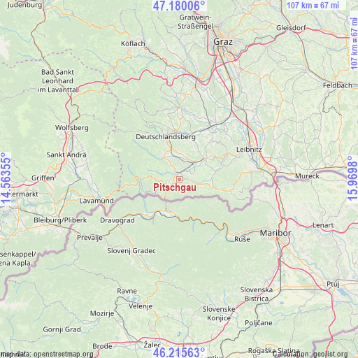
Pitschgau GPS coordinates[2]
46° 42' 0" North, 15° 16' 0.012" East
| Map corner | latitude | longitude |
|---|---|---|
| Upper-left | 47.18006°, | 14.56355° |
| Center: | 46.7°, | 15.26667° |
| Lower-right: | 46.21563°, | 15.9698° |
| Map W x H: | 107.2×107.2 km | = 66.6×66.6mi |
| max Lat: | 48.98333° ⇑95.4% North |
| Pitschgau: | 46.7° |
| min Lat: | ⇓4.6% South 46.48841° |
| min Long | Pitschgau | max Long |
| 9.57802° | 15.26667° | 17.1° |
| W 59.2%⇐ | ⇒40.8% E |
Elevation
Elevation of Pitschgau is 352 m = 1155 ft, and this is 153.5 m = 504 ft below average elevation for this country.
| Max E: |
2140 m = 7021 ft | 65.5% |
| Avg. | 505.5 m = 1658 ft | |
| Pitschgau | 352 m = 1155 ft | |
Min E: |
118 m = 387 ft | 34.5% |
See also: Austria elevation on elevation.city.
Geographical zone
Pitschgau is located in North temperate zone (between Tropic of Cancer and the Arctic Circle). Distance of this North polar circle is 2208.6 km =1372.4 mi to North.| Distance of | km | miles | from Pitschgau |
|---|---|---|---|
| North Pole | 4814.5 | 2991.6 | to North |
| Arctic Circle | 2208.6 | 1372.4 | to North |
| Tropic Cancer | 2586.6 | 1607.2 | to South |
| Equator | 5192.6 | 3226.5 | to South |


Nearby cities:
15 places around Pitschgau: (largest is in red/bold)
• Aibl
3.7 km =2.3 mi,  236°
236°
• Altenmarkt bei Wies
2.2 km =1.4 mi,  325°
325°
• Brunn
4.1 km =2.5 mi,  37°
37°
• Eibiswald
2.1 km =1.3 mi,  225°
225°
• Gleinstätten
9.9 km =6.2 mi,  52°
52°
• Hörmsdorf
0.8 km =0.5 mi,  199°
199°
• Mitterlimberg
4.5 km =2.8 mi, 325°
• Oberhaag
5.2 km =3.2 mi,  106°
106°
• Sankt Martin im Sulmtal
6.7 km =4.2 mi,  20°
20°
• Sankt Oswald ob Eibiswald
9.2 km =5.7 mi,  275°
275°
• Sankt Peter im Sulmtal
5.7 km =3.5 mi,  347°
347°
• Schwanberg
7.9 km =4.9 mi, 325°
• Untergreith
6.6 km =4.1 mi,  73°
73°
• Wernersdorf
4.9 km =3 mi,  291°
291°
• Wies
2.3 km =1.4 mi,  10°
10°
Sources, notices
• [Note1] Compared only with cities in Austria existing in our database
• [Src1] Map data: © OpenStreetMap contributors (CC-BY-SA)
• [Src2] Other city data from geonames.org with taken over terms of usage.
• [Src3] Geographical zone / Annual Mean Temperature by Robert A. Rohde @ Wikipedia
