Hollenegg geodata
Hollenegg (Styria) is a seat of a third-order administrative division; located in Austria in Europe/Vienna (GMT+2) time zone. With population of 201 people, there are 2849 cities with bigger population in this country. Compared to other cities in Austria, 92.1% of cities are located further ↑North; 57.7% of cities are located further ←West and 52.7% of cities have lower elevation than Hollenegg. Note1
Administrative division(s):
- Level 1: Styria
- Level 2: Politischer Bezirk Deutschlandsberg
- Level 3: Schwanberg


Hollenegg GPS coordinates[2]
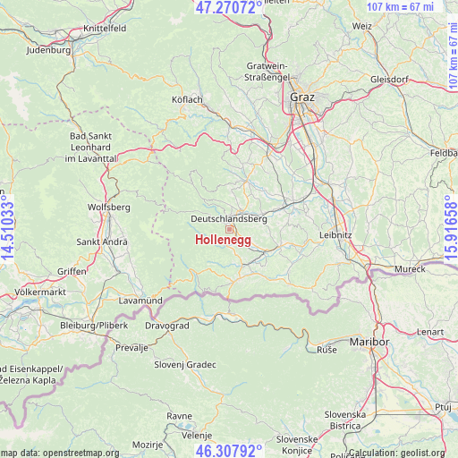
46° 47' 29.292" North, 15° 12' 48.42" East
| Map corner | latitude | longitude |
|---|---|---|
| Upper-left | 47.27072°, | 14.51033° |
| Center: | 46.79147°, | 15.21345° |
| Lower-right: | 46.30792°, | 15.91658° |
| Map W x H: | 107.1×107.1 km | = 66.5×66.5mi |
| max Lat: | 48.98333° ⇑92.1% North |
| Hollenegg: | 46.79147° |
| min Lat: | ⇓7.9% South 46.48841° |
| min Long | Hollenegg | max Long |
| 9.57802° | 15.21345° | 17.1° |
| W 57.7%⇐ | ⇒42.3% E |
Elevation
Elevation of Hollenegg is 470 m = 1542 ft, and this is 35.5 m = 116 ft below average elevation for this country.
| Max E: |
2140 m = 7021 ft | 47.3% |
| Avg. | 505.5 m = 1658 ft | |
| Hollenegg | 470 m = 1542 ft | |
Min E: |
118 m = 387 ft | 52.7% |
See also: Austria elevation on elevation.city.
Geographical zone
Hollenegg is located in North temperate zone (between Tropic of Cancer and the Arctic Circle). Distance of this North polar circle is 2198.5 km =1366.1 mi to North.| Distance of | km | miles | from Hollenegg |
|---|---|---|---|
| North Pole | 4804.3 | 2985.3 | to North |
| Arctic Circle | 2198.5 | 1366.1 | to North |
| Tropic Cancer | 2596.8 | 1613.6 | to South |
| Equator | 5202.7 | 3232.8 | to South |


Nearby cities:
15 places around Hollenegg: (largest is in red/bold)
• Deutschlandsberg
2.7 km =1.7 mi,  14°
14°
• Freidorf an der Laßnitz
3.9 km =2.4 mi,  44°
44°
• Freiland bei Deutschlandsberg
7.7 km =4.8 mi,  307°
307°
• Garanas
7.9 km =4.9 mi,  249°
249°
• Gressenberg
7.4 km =4.6 mi,  277°
277°
• Lassnitz
3.9 km =2.4 mi, 44°
• Mainsdorf
4.5 km =2.8 mi,  232°
232°
• Mitterlimberg
6.6 km =4.1 mi,  166°
166°
• Rassach
8.8 km =5.5 mi,  29°
29°
• Sankt Martin im Sulmtal
7.5 km =4.7 mi,  121°
121°
• Sankt Peter im Sulmtal
5.4 km =3.4 mi,  148°
148°
• Schwanberg
3.7 km =2.3 mi,  186°
186°
• Trahütten
5.7 km =3.5 mi, 310°
• Unterbergla
7.9 km =4.9 mi,  77°
77°
• Wernersdorf
8.4 km =5.2 mi,  183°
183°
Sources, notices
• [Note1] Compared only with cities in Austria existing in our database
• [Src1] Map data: © OpenStreetMap contributors (CC-BY-SA)
• [Src2] Other city data from geonames.org with taken over terms of usage.
• [Src3] Geographical zone / Annual Mean Temperature by Robert A. Rohde @ Wikipedia
