Weitersfelden geodata
Weitersfelden (Upper Austria) is a seat of a third-order administrative division; located in Austria in Europe/Vienna (GMT+2) time zone. With population of 342 people, there are 2694 cities with bigger population in this country. Compared to other cities in Austria, 93.7% of cities are located further ↓South; 50% of cities are located further ←West and 80.6% of cities have lower elevation than Weitersfelden. Note1
Administrative division(s):
- Level 1: Upper Austria
- Level 2: Politischer Bezirk Freistadt
- Level 3: Weitersfelden


Weitersfelden GPS coordinates[2]
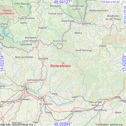
48° 28' 38.28" North, 14° 43' 31.656" East
| Map corner | latitude | longitude |
|---|---|---|
| Upper-left | 48.94127°, | 14.02234° |
| Center: | 48.4773°, | 14.72546° |
| Lower-right: | 48.00904°, | 15.42859° |
| Map W x H: | 103.7×103.7 km | = 64.4×64.4mi |
| max Lat: | 48.98333° ⇑6.3% North |
| Weitersfelden: | 48.4773° |
| min Lat: | ⇓93.7% South 46.48841° |
| min Long | Weitersfelden | max Long |
| 9.57802° | 14.72546° | 17.1° |
| W 50%⇐ | ⇒50% E |
Elevation
Elevation of Weitersfelden is 729 m = 2392 ft, and this is 223.5 m = 733 ft above average elevation for this country.
| Max E: |
2140 m = 7021 ft | 19.4% |
| Weitersfelden | 729 m 2392 ft | |
| Avg. | 505.5 m = 1658 ft | |
Min E: |
118 m = 387 ft | 80.6% |
See also: Austria elevation on elevation.city.
Geographical zone
Weitersfelden is located in North temperate zone (between Tropic of Cancer and the Arctic Circle). Distance of this North polar circle is 2011 km =1249.6 mi to North.| Distance of | km | miles | from Weitersfelden |
|---|---|---|---|
| North Pole | 4616.9 | 2868.8 | to North |
| Arctic Circle | 2011 | 1249.6 | to North |
| Tropic Cancer | 2784.3 | 1730.1 | to South |
| Equator | 5390.2 | 3349.3 | to South |


Nearby cities:
15 places around Weitersfelden: (largest is in red/bold)
• Bad Zell
14.8 km =9.2 mi,  196°
196°
• Freistadt
16.7 km =10.4 mi,  282°
282°
• Grünbach
15.5 km =9.6 mi,  295°
295°
• Gutau
10.7 km =6.6 mi,  231°
231°
• Kefermarkt
14.3 km =8.9 mi,  254°
254°
• Königswiesen
11.6 km =7.2 mi,  134°
134°
• Langschlag
15.9 km =9.9 mi,  47°
47°
• Lasberg
13.7 km =8.5 mi,  267°
267°
• Mönchdorf
13.9 km =8.6 mi,  158°
158°
• Pierbach
14.5 km =9 mi,  171°
171°
• Sandl
11.1 km =6.9 mi,  326°
326°
• Sankt Leonhard bei Freistadt
5.1 km =3.2 mi,  223°
223°
• Sankt Oswald bei Freistadt
10.8 km =6.7 mi, 283°
• Schönau im Mühlkreis
9.2 km =5.7 mi,  177°
177°
• Unterweissenbach
6.3 km =3.9 mi,  138°
138°
Sources, notices
• [Note1] Compared only with cities in Austria existing in our database
• [Src1] Map data: © OpenStreetMap contributors (CC-BY-SA)
• [Src2] Other city data from geonames.org with taken over terms of usage.
• [Src3] Geographical zone / Annual Mean Temperature by Robert A. Rohde @ Wikipedia
