Mönchdorf geodata
Mönchdorf (Upper Austria) is a populated place; located in Austria in Europe/Vienna (GMT+2) time zone. With population of 519 people, there are 2436 cities with bigger population in this country. Compared to other cities in Austria, 89% of cities are located further ↓South; 51.3% of cities are located further ←West and 76.7% of cities have lower elevation than Mönchdorf. Note1
Administrative division(s):
- Level 1: Upper Austria
- Level 2: Politischer Bezirk Freistadt
- Level 3: Königswiesen


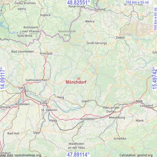
Mönchdorf GPS coordinates[2]
48° 21' 37.692" North, 14° 47' 39.444" East
| Map corner | latitude | longitude |
|---|---|---|
| Upper-left | 48.82551°, | 14.09117° |
| Center: | 48.36047°, | 14.79429° |
| Lower-right: | 47.89114°, | 15.49742° |
| Map W x H: | 103.9×103.9 km | = 64.6×64.6mi |
| max Lat: | 48.98333° ⇑11% North |
| Mönchdorf: | 48.36047° |
| min Lat: | ⇓89% South 46.48841° |
| min Long | Mönchdorf | max Long |
| 9.57802° | 14.79429° | 17.1° |
| W 51.3%⇐ | ⇒48.7% E |
Elevation
Elevation of Mönchdorf is 673 m = 2208 ft, and this is 167.5 m = 550 ft above average elevation for this country.
| Max E: |
2140 m = 7021 ft | 23.3% |
| Mönchdorf | 673 m 2208 ft | |
| Avg. | 505.5 m = 1658 ft | |
Min E: |
118 m = 387 ft | 76.7% |
See also: Austria elevation on elevation.city.
Geographical zone
Mönchdorf is located in North temperate zone (between Tropic of Cancer and the Arctic Circle). Distance of this North polar circle is 2024 km =1257.7 mi to North.| Distance of | km | miles | from Mönchdorf |
|---|---|---|---|
| North Pole | 4629.9 | 2876.9 | to North |
| Arctic Circle | 2024 | 1257.7 | to North |
| Tropic Cancer | 2771.3 | 1722 | to South |
| Equator | 5377.2 | 3341.2 | to South |


Nearby cities:
15 places around Mönchdorf: (largest is in red/bold)
• Allerheiligen im Mühlkreis
12.4 km =7.7 mi,  238°
238°
• Bad Kreuzen
10.4 km =6.5 mi,  175°
175°
• Bad Zell
9.3 km =5.8 mi,  262°
262°
• Dorfstetten
14.4 km =8.9 mi,  105°
105°
• Königswiesen
5.9 km =3.7 mi,  33°
33°
• Münzbach
12.1 km =7.5 mi,  211°
211°
• Pabneukirchen
4.4 km =2.7 mi,  157°
157°
• Pierbach
3.2 km =2 mi, 244°
• Sankt Georgen am Walde
8 km =5 mi,  90°
90°
• Sankt Leonhard bei Freistadt
12.6 km =7.8 mi,  317°
317°
• Schönau im Mühlkreis
6.1 km =3.8 mi,  308°
308°
• Tragwein
13.1 km =8.1 mi, 256°
• Unterweissenbach
8.3 km =5.2 mi,  353°
353°
• Weitersfelden
13.9 km =8.6 mi,  338°
338°
• Windhaag bei Perg
11.8 km =7.3 mi,  225°
225°
Sources, notices
• [Note1] Compared only with cities in Austria existing in our database
• [Src1] Map data: © OpenStreetMap contributors (CC-BY-SA)
• [Src2] Other city data from geonames.org with taken over terms of usage.
• [Src3] Geographical zone / Annual Mean Temperature by Robert A. Rohde @ Wikipedia
