Weilbach geodata
Weilbach (Upper Austria) is a seat of a third-order administrative division; located in Austria in Europe/Vienna (GMT+2) time zone. With population of 176 people, there are 2872 cities with bigger population in this country. Compared to other cities in Austria, 84.5% of cities are located further ↓South; 76.9% of cities are located further →East and 60.1% of cities have higher elevation than Weilbach. Note1
Administrative division(s):
- Level 1: Upper Austria
- Level 2: Politischer Bezirk Ried im Innkreis
- Level 3: Weilbach


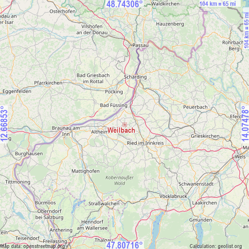
Weilbach GPS coordinates[2]
48° 16' 38.1" North, 13° 22' 17.94" East
| Map corner | latitude | longitude |
|---|---|---|
| Upper-left | 48.74306°, | 12.66853° |
| Center: | 48.27725°, | 13.37165° |
| Lower-right: | 47.80716°, | 14.07478° |
| Map W x H: | 104.1×104.1 km | = 64.7×64.7mi |
| max Lat: | 48.98333° ⇑15.5% North |
| Weilbach: | 48.27725° |
| min Lat: | ⇓84.5% South 46.48841° |
| min Long | Weilbach | max Long |
| 9.57802° | 13.37165° | 17.1° |
| W 23.1%⇐ | ⇒76.9% E |
Elevation
Elevation of Weilbach is 382 m = 1253 ft, and this is 123.5 m = 405 ft below average elevation for this country.
| Max E: |
2140 m = 7021 ft | 60.1% |
| Avg. | 505.5 m = 1658 ft | |
| Weilbach | 382 m = 1253 ft | |
Min E: |
118 m = 387 ft | 39.9% |
See also: Austria elevation on elevation.city.
Geographical zone
Weilbach is located in North temperate zone (between Tropic of Cancer and the Arctic Circle). Distance of this North polar circle is 2033.2 km =1263.4 mi to North.| Distance of | km | miles | from Weilbach |
|---|---|---|---|
| North Pole | 4639.1 | 2882.6 | to North |
| Arctic Circle | 2033.2 | 1263.4 | to North |
| Tropic Cancer | 2762 | 1716.2 | to South |
| Equator | 5367.9 | 3335.5 | to South |


Nearby cities:
15 places around Weilbach: (largest is in red/bold)
• Antiesenhofen
7.8 km =4.8 mi,  15°
15°
• Aurolzmünster
7 km =4.3 mi,  117°
117°
• Diesseits
5 km =3.1 mi,  70°
70°
• Forchtenau
6.1 km =3.8 mi,  103°
103°
• Geinberg
5.9 km =3.7 mi,  255°
255°
• Gurten
4.5 km =2.8 mi,  206°
206°
• Maierhof
7.8 km =4.8 mi, 119°
• Obernberg am Inn
5.6 km =3.5 mi,  330°
330°
• Ort im Innkreis
6.3 km =3.9 mi,  46°
46°
• Polling im Innkreis
8.5 km =5.3 mi,  232°
232°
• Reichersberg
6.6 km =4.1 mi,  352°
352°
• Sankt Georgen bei Obernberg am Inn
3.3 km =2.1 mi,  299°
299°
• Sankt Martin im Innkreis
5.3 km =3.3 mi, 69°
• Utzenaich
6.6 km =4.1 mi,  90°
90°
• Wippenham
6.1 km =3.8 mi,  174°
174°
Sources, notices
• [Note1] Compared only with cities in Austria existing in our database
• [Src1] Map data: © OpenStreetMap contributors (CC-BY-SA)
• [Src2] Other city data from geonames.org with taken over terms of usage.
• [Src3] Geographical zone / Annual Mean Temperature by Robert A. Rohde @ Wikipedia
