Diesseits geodata
Diesseits (Upper Austria) is a populated place; located in Austria in Europe/Vienna (GMT+2) time zone. With population of 1,176 people, there are 1075 cities with bigger population in this country. Compared to other cities in Austria, 85.5% of cities are located further ↓South; 76% of cities are located further →East and 61.8% of cities have higher elevation than Diesseits. Note1
Administrative division(s):
- Level 1: Upper Austria
- Level 2: Politischer Bezirk Ried im Innkreis
- Level 3: Sankt Martin im Innkreis


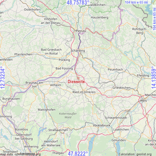
Diesseits GPS coordinates[2]
48° 17' 31.776" North, 13° 26' 7.656" East
| Map corner | latitude | longitude |
|---|---|---|
| Upper-left | 48.75783°, | 12.73234° |
| Center: | 48.29216°, | 13.43546° |
| Lower-right: | 47.8222°, | 14.13859° |
| Map W x H: | 104×104 km | = 64.6×64.6mi |
| max Lat: | 48.98333° ⇑14.5% North |
| Diesseits: | 48.29216° |
| min Lat: | ⇓85.5% South 46.48841° |
| min Long | Diesseits | max Long |
| 9.57802° | 13.43546° | 17.1° |
| W 24%⇐ | ⇒76% E |
Elevation
Elevation of Diesseits is 371 m = 1217 ft, and this is 134.5 m = 441 ft below average elevation for this country.
| Max E: |
2140 m = 7021 ft | 61.8% |
| Avg. | 505.5 m = 1658 ft | |
| Diesseits | 371 m = 1217 ft | |
Min E: |
118 m = 387 ft | 38.2% |
See also: Austria elevation on elevation.city.
Geographical zone
Diesseits is located in North temperate zone (between Tropic of Cancer and the Arctic Circle). Distance of this North polar circle is 2031.6 km =1262.4 mi to North.| Distance of | km | miles | from Diesseits |
|---|---|---|---|
| North Pole | 4637.5 | 2881.6 | to North |
| Arctic Circle | 2031.6 | 1262.4 | to North |
| Tropic Cancer | 2763.7 | 1717.3 | to South |
| Equator | 5369.6 | 3336.5 | to South |


Nearby cities:
15 places around Diesseits: (largest is in red/bold)
• Antiesenhofen
6.4 km =4 mi,  335°
335°
• Aurolzmünster
5.1 km =3.2 mi,  163°
163°
• Forchtenau
3.3 km =2.1 mi, 158°
• Gurten
8.8 km =5.5 mi,  230°
230°
• Maierhof
5.9 km =3.7 mi, 158°
• Mehrnbach
9.3 km =5.8 mi,  180°
180°
• Obernberg am Inn
8.2 km =5.1 mi,  293°
293°
• Ort im Innkreis
2.7 km =1.7 mi,  357°
357°
• Reichersberg
7.4 km =4.6 mi,  311°
311°
• Sankt Georgen bei Obernberg am Inn
7.6 km =4.7 mi,  269°
269°
• Sankt Martin im Innkreis
0.3 km =0.2 mi,  51°
51°
• Tumeltsham
8.1 km =5 mi,  145°
145°
• Utzenaich
2.6 km =1.6 mi,  133°
133°
• Weilbach
5 km =3.1 mi,  250°
250°
• Wippenham
8.8 km =5.5 mi,  208°
208°
Sources, notices
• [Note1] Compared only with cities in Austria existing in our database
• [Src1] Map data: © OpenStreetMap contributors (CC-BY-SA)
• [Src2] Other city data from geonames.org with taken over terms of usage.
• [Src3] Geographical zone / Annual Mean Temperature by Robert A. Rohde @ Wikipedia
