Gurten geodata
Gurten (Upper Austria) is a populated place; located in Austria in Europe/Vienna (GMT+2) time zone. With population of 650 people, there are 1987 cities with bigger population in this country. Compared to other cities in Austria, 82.1% of cities are located further ↓South; 77.3% of cities are located further →East and 58.8% of cities have higher elevation than Gurten. Note1
Administrative division(s):
- Level 1: Upper Austria
- Level 2: Politischer Bezirk Ried im Innkreis
- Level 3: Gurten


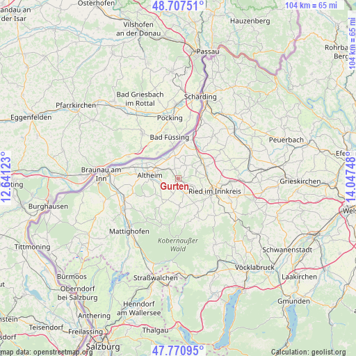
Gurten GPS coordinates[2]
48° 14' 28.932" North, 13° 20' 39.66" East
| Map corner | latitude | longitude |
|---|---|---|
| Upper-left | 48.70751°, | 12.64123° |
| Center: | 48.24137°, | 13.34435° |
| Lower-right: | 47.77095°, | 14.04748° |
| Map W x H: | 104.1×104.1 km | = 64.7×64.7mi |
| max Lat: | 48.98333° ⇑17.9% North |
| Gurten: | 48.24137° |
| min Lat: | ⇓82.1% South 46.48841° |
| min Long | Gurten | max Long |
| 9.57802° | 13.34435° | 17.1° |
| W 22.7%⇐ | ⇒77.3% E |
Elevation
Elevation of Gurten is 393 m = 1289 ft, and this is 112.5 m = 369 ft below average elevation for this country.
| Max E: |
2140 m = 7021 ft | 58.8% |
| Avg. | 505.5 m = 1658 ft | |
| Gurten | 393 m = 1289 ft | |
Min E: |
118 m = 387 ft | 41.2% |
See also: Austria elevation on elevation.city.
Geographical zone
Gurten is located in North temperate zone (between Tropic of Cancer and the Arctic Circle). Distance of this North polar circle is 2037.2 km =1265.9 mi to North.| Distance of | km | miles | from Gurten |
|---|---|---|---|
| North Pole | 4643.1 | 2885.1 | to North |
| Arctic Circle | 2037.2 | 1265.9 | to North |
| Tropic Cancer | 2758 | 1713.7 | to South |
| Equator | 5363.9 | 3333 | to South |


Nearby cities:
15 places around Gurten: (largest is in red/bold)
• Altheim
8.2 km =5.1 mi,  277°
277°
• Aspach
6.9 km =4.3 mi,  205°
205°
• Aurolzmünster
8.3 km =5.2 mi,  84°
84°
• Diesseits
8.8 km =5.5 mi,  50°
50°
• Forchtenau
8.4 km =5.2 mi,  72°
72°
• Geinberg
4.5 km =2.8 mi,  303°
303°
• Maierhof
8.9 km =5.5 mi,  88°
88°
• Mehrnbach
7.7 km =4.8 mi,  118°
118°
• Obernberg am Inn
8.9 km =5.5 mi,  355°
355°
• Polling im Innkreis
4.9 km =3 mi,  256°
256°
• Sankt Georgen bei Obernberg am Inn
5.7 km =3.5 mi,  351°
351°
• Sankt Martin im Innkreis
9.1 km =5.7 mi, 50°
• Weilbach
4.5 km =2.8 mi,  26°
26°
• Wildenau
4.4 km =2.7 mi, 207°
• Wippenham
3.3 km =2.1 mi,  129°
129°
Sources, notices
• [Note1] Compared only with cities in Austria existing in our database
• [Src1] Map data: © OpenStreetMap contributors (CC-BY-SA)
• [Src2] Other city data from geonames.org with taken over terms of usage.
• [Src3] Geographical zone / Annual Mean Temperature by Robert A. Rohde @ Wikipedia
