Wagrain geodata
Wagrain (Salzburg) is a seat of a third-order administrative division; located in Austria in Europe/Vienna (GMT+2) time zone. With population of 372 people, there are 2654 cities with bigger population in this country. Compared to other cities in Austria, 63.2% of cities are located further ↑North; 77.9% of cities are located further →East and 88.3% of cities have lower elevation than Wagrain. Note1
Administrative division(s):
- Level 1: Salzburg
- Level 2: Politischer Bezirk Sankt Johann im Pongau
- Level 3: Wagrain


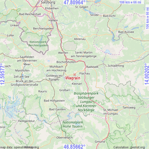
Wagrain GPS coordinates[2]
47° 20' 7.008" North, 13° 17' 56.004" East
| Map corner | latitude | longitude |
|---|---|---|
| Upper-left | 47.80964°, | 12.59577° |
| Center: | 47.33528°, | 13.29889° |
| Lower-right: | 46.85662°, | 14.00202° |
| Map W x H: | 106×106 km | = 65.9×65.9mi |
| max Lat: | 48.98333° ⇑63.2% North |
| Wagrain: | 47.33528° |
| min Lat: | ⇓36.8% South 46.48841° |
| min Long | Wagrain | max Long |
| 9.57802° | 13.29889° | 17.1° |
| W 22.1%⇐ | ⇒77.9% E |
Elevation
Elevation of Wagrain is 849 m = 2785 ft, and this is 343.5 m = 1127 ft above average elevation for this country.
| Max E: |
2140 m = 7021 ft | 11.7% |
| Wagrain | 849 m 2785 ft | |
| Avg. | 505.5 m = 1658 ft | |
Min E: |
118 m = 387 ft | 88.3% |
See also: Austria elevation on elevation.city.
Geographical zone
Wagrain is located in North temperate zone (between Tropic of Cancer and the Arctic Circle). Distance of this North polar circle is 2138 km =1328.5 mi to North.| Distance of | km | miles | from Wagrain |
|---|---|---|---|
| North Pole | 4743.9 | 2947.7 | to North |
| Arctic Circle | 2138 | 1328.5 | to North |
| Tropic Cancer | 2657.3 | 1651.2 | to South |
| Equator | 5263.2 | 3270.4 | to South |


Nearby cities:
15 places around Wagrain: (largest is in red/bold)
• Am Feuersang
8.4 km =5.2 mi,  65°
65°
• Flachau
7 km =4.3 mi,  82°
82°
• Hof
2.1 km =1.3 mi,  39°
39°
• Hofmarkt
2.6 km =1.6 mi,  173°
173°
• Höch
7.3 km =4.5 mi,  61°
61°
• Hüttau
9 km =5.6 mi,  4°
4°
• Kleinarl
6.6 km =4.1 mi, 166°
• Maschl
8.2 km =5.1 mi,  295°
295°
• Mitterberghütten
9.5 km =5.9 mi,  319°
319°
• Plankenau
8 km =5 mi,  263°
263°
• Reinbach
8.2 km =5.1 mi,  278°
278°
• Reitdorf
7.3 km =4.5 mi, 61°
• Rettenstein
6.4 km =4 mi, 284°
• Sankt Johann im Pongau
7.6 km =4.7 mi, 282°
• Sonnberg
9.1 km =5.7 mi,  8°
8°
Sources, notices
• [Note1] Compared only with cities in Austria existing in our database
• [Src1] Map data: © OpenStreetMap contributors (CC-BY-SA)
• [Src2] Other city data from geonames.org with taken over terms of usage.
• [Src3] Geographical zone / Annual Mean Temperature by Robert A. Rohde @ Wikipedia
