Flachau geodata
Flachau (Salzburg) is a seat of a third-order administrative division; located in Austria in Europe/Vienna (GMT+2) time zone. With population of 827 people, there are 1561 cities with bigger population in this country. Compared to other cities in Austria, 63% of cities are located further ↑North; 76.7% of cities are located further →East and 91.3% of cities have lower elevation than Flachau. Note1
Administrative division(s):
- Level 1: Salzburg
- Level 2: Politischer Bezirk Sankt Johann im Pongau
- Level 3: Flachau


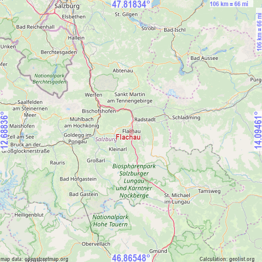
Flachau GPS coordinates[2]
47° 20' 38.616" North, 13° 23' 29.328" East
| Map corner | latitude | longitude |
|---|---|---|
| Upper-left | 47.81834°, | 12.68836° |
| Center: | 47.34406°, | 13.39148° |
| Lower-right: | 46.86548°, | 14.09461° |
| Map W x H: | 105.9×105.9 km | = 65.8×65.8mi |
| max Lat: | 48.98333° ⇑63% North |
| Flachau: | 47.34406° |
| min Lat: | ⇓37% South 46.48841° |
| min Long | Flachau | max Long |
| 9.57802° | 13.39148° | 17.1° |
| W 23.3%⇐ | ⇒76.7% E |
Elevation
Elevation of Flachau is 907 m = 2976 ft, and this is 401.5 m = 1317 ft above average elevation for this country.
| Max E: |
2140 m = 7021 ft | 8.7% |
| Flachau | 907 m 2976 ft | |
| Avg. | 505.5 m = 1658 ft | |
Min E: |
118 m = 387 ft | 91.3% |
See also: Austria elevation on elevation.city.
Geographical zone
Flachau is located in North temperate zone (between Tropic of Cancer and the Arctic Circle). Distance of this North polar circle is 2137 km =1327.9 mi to North.| Distance of | km | miles | from Flachau |
|---|---|---|---|
| North Pole | 4742.9 | 2947.1 | to North |
| Arctic Circle | 2137 | 1327.9 | to North |
| Tropic Cancer | 2658.2 | 1651.7 | to South |
| Equator | 5264.2 | 3271 | to South |


Nearby cities:
15 places around Flachau: (largest is in red/bold)
• Altenmarkt im Pongau
4.8 km =3 mi,  23°
23°
• Am Feuersang
2.6 km =1.6 mi,  14°
14°
• Eben im Pongau
6.3 km =3.9 mi, 5°
• Hof
5.7 km =3.5 mi,  276°
276°
• Hofmarkt
7.6 km =4.7 mi,  241°
241°
• Höch
2.6 km =1.6 mi,  346°
346°
• Hüttau
10.2 km =6.3 mi,  321°
321°
• Kleinarl
9.2 km =5.7 mi,  216°
216°
• Löbenau
8.2 km =5.1 mi,  57°
57°
• Radstadt
6.2 km =3.9 mi,  45°
45°
• Reitdorf
2.6 km =1.6 mi, 346°
• Schwemmberg
9.1 km =5.7 mi, 48°
• Sonnberg
9.8 km =6.1 mi,  325°
325°
• Untertauern
9.5 km =5.9 mi,  120°
120°
• Wagrain
7 km =4.3 mi,  262°
262°
Sources, notices
• [Note1] Compared only with cities in Austria existing in our database
• [Src1] Map data: © OpenStreetMap contributors (CC-BY-SA)
• [Src2] Other city data from geonames.org with taken over terms of usage.
• [Src3] Geographical zone / Annual Mean Temperature by Robert A. Rohde @ Wikipedia
