Warmbad-Judendorf geodata
Warmbad-Judendorf (Carinthia) is a section of populated place; located in Austria in Europe/Vienna (GMT+2) time zone. With population of 2,302 people, there are 527 cities with bigger population in this country. Compared to other cities in Austria, 98.6% of cities are located further ↑North; 68.5% of cities are located further →East and 58.5% of cities have lower elevation than Warmbad-Judendorf. Note1


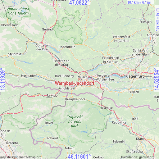
Warmbad-Judendorf GPS coordinates[2]
46° 36' 4.536" North, 13° 49' 20.676" East
| Map corner | latitude | longitude |
|---|---|---|
| Upper-left | 47.0822°, | 13.11929° |
| Center: | 46.60126°, | 13.82241° |
| Lower-right: | 46.11601°, | 14.52554° |
| Map W x H: | 107.4×107.4 km | = 66.7×66.7mi |
| max Lat: | 48.98333° ⇑98.6% North |
| Warmbad-Judendorf: | 46.60126° |
| min Lat: | ⇓1.4% South 46.48841° |
| min Long | Warmbad-Judendo | max Long |
| 9.57802° | 13.82241° | 17.1° |
| W 31.5%⇐ | ⇒68.5% E |
Elevation
Elevation of Warmbad-Judendorf is 508 m = 1667 ft, and this is 2.5 m = 8 ft above average elevation for this country.
| Max E: |
2140 m = 7021 ft | 41.5% |
| Warmbad-Judendorf | 508 m 1667 ft | |
| Avg. | 505.5 m = 1658 ft | |
Min E: |
118 m = 387 ft | 58.5% |
See also: Austria elevation on elevation.city.
Geographical zone
Warmbad-Judendorf is located in North temperate zone (between Tropic of Cancer and the Arctic Circle). Distance of this North polar circle is 2219.6 km =1379.2 mi to North.| Distance of | km | miles | from Warmbad-Judendorf |
|---|---|---|---|
| North Pole | 4825.5 | 2998.4 | to North |
| Arctic Circle | 2219.6 | 1379.2 | to North |
| Tropic Cancer | 2575.7 | 1600.5 | to South |
| Equator | 5181.6 | 3219.7 | to South |


Nearby cities:
15 places around Warmbad-Judendorf: (largest is in red/bold)
• Auen
1.7 km =1.1 mi,  96°
96°
• Goritschach
1.6 km =1 mi,  319°
319°
• Großvassach
3.6 km =2.2 mi,  35°
35°
• Kleinvassach
4 km =2.5 mi, 35°
• Lind
3 km =1.9 mi, 38°
• Neufellach
2.4 km =1.5 mi,  346°
346°
• Obere Fellach
3.2 km =2 mi,  341°
341°
• Sankt Leonhard
3.8 km =2.4 mi,  46°
46°
• Sankt Martin
1.8 km =1.1 mi,  15°
15°
• Seebach
3.8 km =2.4 mi,  63°
63°
• St. Agathen und Perau
2.6 km =1.6 mi,  77°
77°
• Untere Fellach
2.7 km =1.7 mi,  7°
7°
• Villach
2.7 km =1.7 mi,  68°
68°
• Villach-Innere Stadt
2.2 km =1.4 mi, 55°
• Völkendorf
1 km =0.6 mi, 42°
Sources, notices
• [Note1] Compared only with cities in Austria existing in our database
• [Src1] Map data: © OpenStreetMap contributors (CC-BY-SA)
• [Src2] Other city data from geonames.org with taken over terms of usage.
• [Src3] Geographical zone / Annual Mean Temperature by Robert A. Rohde @ Wikipedia
