Uttendorf geodata
Uttendorf (Upper Austria) is a populated place; located in Austria in Europe/Vienna (GMT+2) time zone. With population of 1,361 people, there are 927 cities with bigger population in this country. Compared to other cities in Austria, 76.2% of cities are located further ↓South; 81% of cities are located further →East and 58.8% of cities have higher elevation than Uttendorf. Note1
Administrative division(s):
- Level 1: Upper Austria
- Level 2: Politischer Bezirk Braunau am Inn
- Level 3: Helpfau-Uttendorf


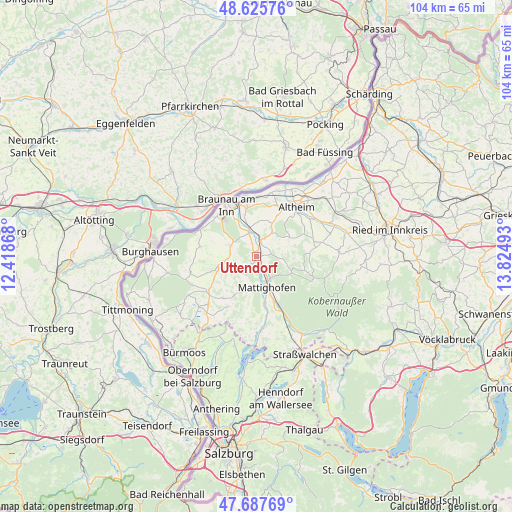
Uttendorf GPS coordinates[2]
48° 9' 31.932" North, 13° 7' 18.48" East
| Map corner | latitude | longitude |
|---|---|---|
| Upper-left | 48.62576°, | 12.41868° |
| Center: | 48.15887°, | 13.1218° |
| Lower-right: | 47.68769°, | 13.82493° |
| Map W x H: | 104.3×104.3 km | = 64.8×64.8mi |
| max Lat: | 48.98333° ⇑23.8% North |
| Uttendorf: | 48.15887° |
| min Lat: | ⇓76.2% South 46.48841° |
| min Long | Uttendorf | max Long |
| 9.57802° | 13.1218° | 17.1° |
| W 19%⇐ | ⇒81% E |
Elevation
Elevation of Uttendorf is 393 m = 1289 ft, and this is 112.5 m = 369 ft below average elevation for this country.
| Max E: |
2140 m = 7021 ft | 58.8% |
| Avg. | 505.5 m = 1658 ft | |
| Uttendorf | 393 m = 1289 ft | |
Min E: |
118 m = 387 ft | 41.2% |
See also: Austria elevation on elevation.city.
Geographical zone
Uttendorf is located in North temperate zone (between Tropic of Cancer and the Arctic Circle). Distance of this North polar circle is 2046.4 km =1271.6 mi to North.| Distance of | km | miles | from Uttendorf |
|---|---|---|---|
| North Pole | 4652.3 | 2890.8 | to North |
| Arctic Circle | 2046.4 | 1271.6 | to North |
| Tropic Cancer | 2748.8 | 1708 | to South |
| Equator | 5354.8 | 3327.3 | to South |


Nearby cities:
15 places around Uttendorf: (largest is in red/bold)
• Burgkirchen
5.3 km =3.3 mi,  342°
342°
• Friedrichsdorf
5.2 km =3.2 mi,  288°
288°
• Handenberg
8.9 km =5.5 mi,  251°
251°
• Höfen
1 km =0.6 mi,  153°
153°
• Maria Schmolln
7.6 km =4.7 mi,  107°
107°
• Mattighofen
6.1 km =3.8 mi,  159°
159°
• Mauerkirchen
3.8 km =2.4 mi,  13°
13°
• Munderfing
10.8 km =6.7 mi, 155°
• Neue Heimat
11.3 km =7 mi,  328°
328°
• Pfaffstätt
9.3 km =5.8 mi,  169°
169°
• Sankt Georgen am Fillmannsbach
9.2 km =5.7 mi, 246°
• Sankt Peter am Hart
10.6 km =6.6 mi,  349°
349°
• Schalchen
5.1 km =3.2 mi, 149°
• Treubach
7.8 km =4.8 mi,  58°
58°
• Weng im Innkreis
9.4 km =5.8 mi,  26°
26°
Sources, notices
• [Note1] Compared only with cities in Austria existing in our database
• [Src1] Map data: © OpenStreetMap contributors (CC-BY-SA)
• [Src2] Other city data from geonames.org with taken over terms of usage.
• [Src3] Geographical zone / Annual Mean Temperature by Robert A. Rohde @ Wikipedia
