Pfaffstätt geodata
Pfaffstätt (Upper Austria) is a populated place; located in Austria in Europe/Vienna (GMT+2) time zone. With population of 865 people, there are 1492 cities with bigger population in this country. Compared to other cities in Austria, 71.2% of cities are located further ↓South; 80.3% of cities are located further →East and 51.5% of cities have lower elevation than Pfaffstätt. Note1
Administrative division(s):
- Level 1: Upper Austria
- Level 2: Politischer Bezirk Braunau am Inn
- Level 3: Pfaffstätt


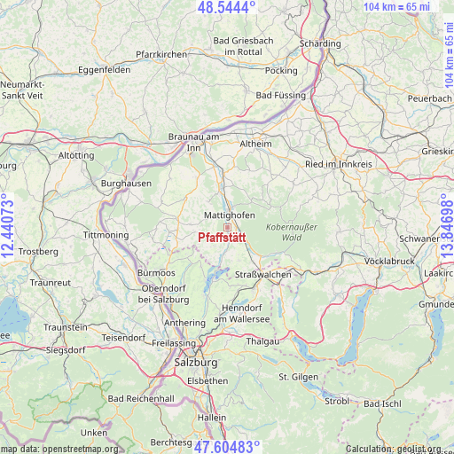
Pfaffstätt GPS coordinates[2]
48° 4' 36.336" North, 13° 8' 37.86" East
| Map corner | latitude | longitude |
|---|---|---|
| Upper-left | 48.5444°, | 12.44073° |
| Center: | 48.07676°, | 13.14385° |
| Lower-right: | 47.60483°, | 13.84698° |
| Map W x H: | 104.5×104.5 km | = 64.9×64.9mi |
| max Lat: | 48.98333° ⇑28.8% North |
| Pfaffstätt: | 48.07676° |
| min Lat: | ⇓71.2% South 46.48841° |
| min Long | Pfaffstätt | max Long |
| 9.57802° | 13.14385° | 17.1° |
| W 19.7%⇐ | ⇒80.3% E |
Elevation
Elevation of Pfaffstätt is 459 m = 1506 ft, and this is 46.5 m = 153 ft below average elevation for this country.
| Max E: |
2140 m = 7021 ft | 48.5% |
| Avg. | 505.5 m = 1658 ft | |
| Pfaffstätt | 459 m = 1506 ft | |
Min E: |
118 m = 387 ft | 51.5% |
See also: Austria elevation on elevation.city.
Geographical zone
Pfaffstätt is located in North temperate zone (between Tropic of Cancer and the Arctic Circle). Distance of this North polar circle is 2055.5 km =1277.2 mi to North.| Distance of | km | miles | from Pfaffstätt |
|---|---|---|---|
| North Pole | 4661.4 | 2896.5 | to North |
| Arctic Circle | 2055.5 | 1277.2 | to North |
| Tropic Cancer | 2739.7 | 1702.4 | to South |
| Equator | 5345.6 | 3321.6 | to South |


Nearby cities:
15 places around Pfaffstätt: (largest is in red/bold)
• Berndorf bei Salzburg
10.9 km =6.8 mi,  214°
214°
• Eggelsberg
11.4 km =7.1 mi,  271°
271°
• Friedburg
10.3 km =6.4 mi,  130°
130°
• Höfen
8.3 km =5.2 mi,  351°
351°
• Lengau
9.6 km =6 mi,  145°
145°
• Lochen
8.1 km =5 mi,  160°
160°
• Maria Schmolln
8.9 km =5.5 mi,  39°
39°
• Mattighofen
3.4 km =2.1 mi,  8°
8°
• Munderfing
2.9 km =1.8 mi,  104°
104°
• Palting
6.9 km =4.3 mi,  190°
190°
• Perwang am Grabensee
9 km =5.6 mi, 210°
• Sankt Georgen am Fillmannsbach
11.4 km =7.1 mi,  298°
298°
• Schalchen
4.8 km =3 mi, 11°
• Uttendorf
9.3 km =5.8 mi, 349°
• Wagnergraben
10.9 km =6.8 mi,  234°
234°
Sources, notices
• [Note1] Compared only with cities in Austria existing in our database
• [Src1] Map data: © OpenStreetMap contributors (CC-BY-SA)
• [Src2] Other city data from geonames.org with taken over terms of usage.
• [Src3] Geographical zone / Annual Mean Temperature by Robert A. Rohde @ Wikipedia
