Sankt Georgen am Fillmannsbach geodata
Sankt Georgen am Fillmannsbach (Upper Austria) is a seat of a third-order administrative division; located in Austria in Europe/Vienna (GMT+2) time zone. With population of 96 people, there are 2927 cities with bigger population in this country. Compared to other cities in Austria, 74% of cities are located further ↓South; 82.9% of cities are located further →East and 50.3% of cities have higher elevation than Sankt Georgen am Fillmannsbach. Note1
Administrative division(s):
- Level 1: Upper Austria
- Level 2: Politischer Bezirk Braunau am Inn
- Level 3: Sankt Georgen am Fillmannsbach
Current local time in Sankt Georgen am Fillmannsbach:
10:35 PM, FridayDifference from your time zone: hours


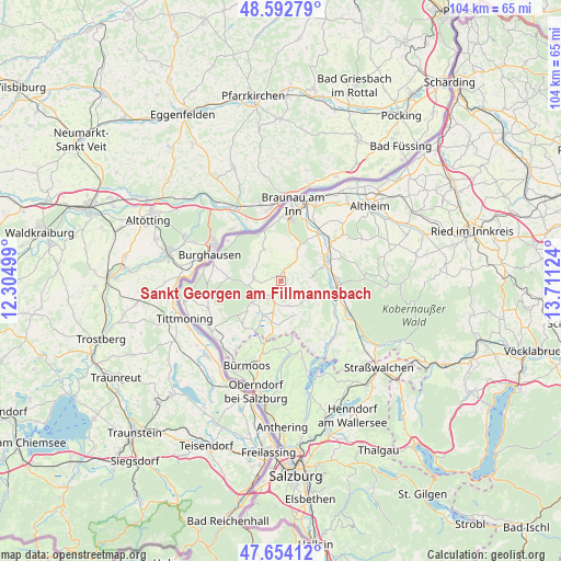
Sankt Georgen am Fillmannsbach GPS coordinates[2]
48° 7' 32.16" North, 13° 0' 29.196" East
| Map corner | latitude | longitude |
|---|---|---|
| Upper-left | 48.59279°, | 12.30499° |
| Center: | 48.1256°, | 13.00811° |
| Lower-right: | 47.65412°, | 13.71124° |
| Map W x H: | 104.4×104.4 km | = 64.9×64.9mi |
| max Lat: | 48.98333° ⇑26% North |
| Sankt Georgen am Fillmannsbach: | 48.1256° |
| min Lat: | ⇓74% South 46.48841° |
| min Long | Sankt Georgen a | max Long |
| 9.57802° | 13.00811° | 17.1° |
| W 17.1%⇐ | ⇒82.9% E |
Elevation
Elevation of Sankt Georgen am Fillmannsbach is 449 m = 1473 ft, and this is 56.5 m = 185 ft below average elevation for this country.
| Max E: |
2140 m = 7021 ft | 50.3% |
| Avg. | 505.5 m = 1658 ft | |
| Sankt Georgen am Fillmannsbach | 449 m = 1473 ft | |
Min E: |
118 m = 387 ft | 49.7% |
See also: Austria elevation on elevation.city.
Geographical zone
Sankt Georgen am Fillmannsbach is located in North temperate zone (between Tropic of Cancer and the Arctic Circle). Distance of this North polar circle is 2050.1 km =1273.9 mi to North.| Distance of | km | miles | from Sankt Georgen am Fillmannsbach |
|---|---|---|---|
| North Pole | 4656 | 2893.1 | to North |
| Arctic Circle | 2050.1 | 1273.9 | to North |
| Tropic Cancer | 2745.1 | 1705.7 | to South |
| Equator | 5351.1 | 3325 | to South |


Nearby cities:
15 places around Sankt Georgen am Fillmannsbach: (largest is in red/bold)
• Burgkirchen
11.1 km =6.9 mi,  37°
37°
• Duttendorf
12 km =7.5 mi,  283°
283°
• Eggelsberg
5.3 km =3.3 mi,  194°
194°
• Friedrichsdorf
6.4 km =4 mi,  33°
33°
• Handenberg
0.9 km =0.6 mi,  357°
357°
• Hochburg-Ach
9.7 km =6 mi,  272°
272°
• Höfen
9.3 km =5.8 mi,  72°
72°
• Mattighofen
10.8 km =6.7 mi,  100°
100°
• Mauerkirchen
11.8 km =7.3 mi,  51°
51°
• Moosdorf
9.1 km =5.7 mi, 188°
• Pfaffstätt
11.4 km =7.1 mi,  118°
118°
• Ranshofen
12 km =7.5 mi,  2°
2°
• Schalchen
11.1 km =6.9 mi,  93°
93°
• Uttendorf
9.2 km =5.7 mi, 66°
• Wagnergraben
11.8 km =7.3 mi,  174°
174°
Sources, notices
• [Note1] Compared only with cities in Austria existing in our database
• [Src1] Map data: © OpenStreetMap contributors (CC-BY-SA)
• [Src2] Other city data from geonames.org with taken over terms of usage.
• [Src3] Geographical zone / Annual Mean Temperature by Robert A. Rohde @ Wikipedia
