Mauerkirchen geodata
Mauerkirchen (Upper Austria) is a populated place; located in Austria in Europe/Vienna (GMT+2) time zone. With population of 2,384 people, there are 512 cities with bigger population in this country. Compared to other cities in Austria, 78.7% of cities are located further ↓South; 80.6% of cities are located further →East and 57.9% of cities have higher elevation than Mauerkirchen. Note1
Administrative division(s):
- Level 1: Upper Austria
- Level 2: Politischer Bezirk Braunau am Inn
- Level 3: Mauerkirchen


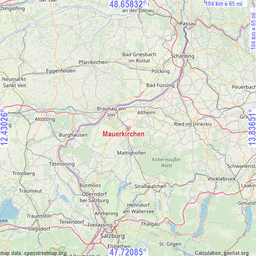
Mauerkirchen GPS coordinates[2]
48° 11' 30.228" North, 13° 8' 0.168" East
| Map corner | latitude | longitude |
|---|---|---|
| Upper-left | 48.65832°, | 12.43026° |
| Center: | 48.19173°, | 13.13338° |
| Lower-right: | 47.72085°, | 13.83651° |
| Map W x H: | 104.2×104.2 km | = 64.7×64.7mi |
| max Lat: | 48.98333° ⇑21.3% North |
| Mauerkirchen: | 48.19173° |
| min Lat: | ⇓78.7% South 46.48841° |
| min Long | Mauerkirchen | max Long |
| 9.57802° | 13.13338° | 17.1° |
| W 19.4%⇐ | ⇒80.6% E |
Elevation
Elevation of Mauerkirchen is 399 m = 1309 ft, and this is 106.5 m = 349 ft below average elevation for this country.
| Max E: |
2140 m = 7021 ft | 57.9% |
| Avg. | 505.5 m = 1658 ft | |
| Mauerkirchen | 399 m = 1309 ft | |
Min E: |
118 m = 387 ft | 42.1% |
See also: Austria elevation on elevation.city.
Geographical zone
Mauerkirchen is located in North temperate zone (between Tropic of Cancer and the Arctic Circle). Distance of this North polar circle is 2042.8 km =1269.3 mi to North.| Distance of | km | miles | from Mauerkirchen |
|---|---|---|---|
| North Pole | 4648.6 | 2888.5 | to North |
| Arctic Circle | 2042.8 | 1269.3 | to North |
| Tropic Cancer | 2752.5 | 1710.3 | to South |
| Equator | 5358.4 | 3329.6 | to South |


Nearby cities:
15 places around Mauerkirchen: (largest is in red/bold)
• Braunau Neustadt
9.4 km =5.8 mi,  309°
309°
• Burgkirchen
2.9 km =1.8 mi,  299°
299°
• Friedrichsdorf
6.1 km =3.8 mi,  250°
250°
• Haselbach
8.9 km =5.5 mi,  320°
320°
• Höfen
4.6 km =2.9 mi,  185°
185°
• Laab
9.7 km =6 mi, 322°
• Maria Schmolln
8.7 km =5.4 mi,  132°
132°
• Mattighofen
9.5 km =5.9 mi,  172°
172°
• Mining
9.7 km =6 mi,  12°
12°
• Neue Heimat
9.1 km =5.7 mi, 311°
• Sankt Peter am Hart
7.3 km =4.5 mi,  337°
337°
• Schalchen
8.3 km =5.2 mi, 167°
• Treubach
5.8 km =3.6 mi,  85°
85°
• Uttendorf
3.8 km =2.4 mi, 193°
• Weng im Innkreis
5.8 km =3.6 mi,  34°
34°
Sources, notices
• [Note1] Compared only with cities in Austria existing in our database
• [Src1] Map data: © OpenStreetMap contributors (CC-BY-SA)
• [Src2] Other city data from geonames.org with taken over terms of usage.
• [Src3] Geographical zone / Annual Mean Temperature by Robert A. Rohde @ Wikipedia
