Unterradlberg geodata
Unterradlberg (Lower Austria) is a section of populated place; located in Austria in Europe/Vienna (GMT+2) time zone. With population of 783 people, there are 1649 cities with bigger population in this country. Compared to other cities in Austria, 83.1% of cities are located further ↓South; 71.3% of cities are located further ←West and 86.2% of cities have higher elevation than Unterradlberg. Note1


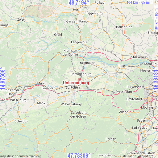
Unterradlberg GPS coordinates[2]
48° 15' 12.132" North, 15° 40' 41.448" East
| Map corner | latitude | longitude |
|---|---|---|
| Upper-left | 48.7194°, | 14.97506° |
| Center: | 48.25337°, | 15.67818° |
| Lower-right: | 47.78306°, | 16.38131° |
| Map W x H: | 104.1×104.1 km | = 64.7×64.7mi |
| max Lat: | 48.98333° ⇑16.9% North |
| Unterradlberg: | 48.25337° |
| min Lat: | ⇓83.1% South 46.48841° |
| min Long | Unterradlberg | max Long |
| 9.57802° | 15.67818° | 17.1° |
| W 71.3%⇐ | ⇒28.7% E |
Elevation
Elevation of Unterradlberg is 241 m = 791 ft, and this is 264.5 m = 868 ft below average elevation for this country.
| Max E: |
2140 m = 7021 ft | 86.2% |
| Avg. | 505.5 m = 1658 ft | |
| Unterradlberg | 241 m = 791 ft | |
Min E: |
118 m = 387 ft | 13.8% |
See also: Austria elevation on elevation.city.
Geographical zone
Unterradlberg is located in North temperate zone (between Tropic of Cancer and the Arctic Circle). Distance of this North polar circle is 2035.9 km =1265 mi to North.| Distance of | km | miles | from Unterradlberg |
|---|---|---|---|
| North Pole | 4641.8 | 2884.3 | to North |
| Arctic Circle | 2035.9 | 1265 | to North |
| Tropic Cancer | 2759.4 | 1714.6 | to South |
| Equator | 5365.3 | 3333.8 | to South |


Nearby cities:
15 places around Unterradlberg: (largest is in red/bold)
• Etzersdorf
5.5 km =3.4 mi,  74°
74°
• Herzogenburg
3.3 km =2.1 mi,  20°
20°
• Inzersdorf ob der Traisen
7 km =4.3 mi,  350°
350°
• Kapelln
5.9 km =3.7 mi,  84°
84°
• Oberndorf in der Ebene
2.1 km =1.3 mi, 24°
• Oberwagram
6.1 km =3.8 mi,  200°
200°
• Ossarn
3.2 km =2 mi,  62°
62°
• Pottenbrunn
2.8 km =1.7 mi,  144°
144°
• Ragelsdorf
3.4 km =2.1 mi,  245°
245°
• Ratzersdorf an der Traisen
3.1 km =1.9 mi, 196°
• Sankt Andrä an der Traisen
5.6 km =3.5 mi,  30°
30°
• Sankt Pölten
6.8 km =4.2 mi,  209°
209°
• Statzendorf
6.6 km =4.1 mi,  335°
335°
• Unterwagram
5 km =3.1 mi, 205°
• Viehofen
6.1 km =3.8 mi,  228°
228°
Sources, notices
• [Note1] Compared only with cities in Austria existing in our database
• [Src1] Map data: © OpenStreetMap contributors (CC-BY-SA)
• [Src2] Other city data from geonames.org with taken over terms of usage.
• [Src3] Geographical zone / Annual Mean Temperature by Robert A. Rohde @ Wikipedia
