Kapelln geodata
Kapelln (Lower Austria) is a seat of a third-order administrative division; located in Austria in Europe/Vienna (GMT+2) time zone. With population of 296 people, there are 2751 cities with bigger population in this country. Compared to other cities in Austria, 83.2% of cities are located further ↓South; 73.5% of cities are located further ←West and 90.1% of cities have higher elevation than Kapelln. Note1
Administrative division(s):
- Level 1: Lower Austria
- Level 2: Politischer Bezirk Sankt Pölten
- Level 3: Kapelln


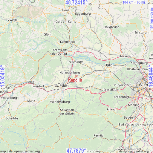
Kapelln GPS coordinates[2]
48° 15' 29.412" North, 15° 45' 26.316" East
| Map corner | latitude | longitude |
|---|---|---|
| Upper-left | 48.72415°, | 15.05419° |
| Center: | 48.25817°, | 15.75731° |
| Lower-right: | 47.7879°, | 16.46044° |
| Map W x H: | 104.1×104.1 km | = 64.7×64.7mi |
| max Lat: | 48.98333° ⇑16.8% North |
| Kapelln: | 48.25817° |
| min Lat: | ⇓83.2% South 46.48841° |
| min Long | Kapelln | max Long |
| 9.57802° | 15.75731° | 17.1° |
| W 73.5%⇐ | ⇒26.5% E |
Elevation
Elevation of Kapelln is 212 m = 696 ft, and this is 293.5 m = 963 ft below average elevation for this country.
| Max E: |
2140 m = 7021 ft | 90.1% |
| Avg. | 505.5 m = 1658 ft | |
| Kapelln | 212 m = 696 ft | |
Min E: |
118 m = 387 ft | 9.9% |
See also: Austria elevation on elevation.city.
Geographical zone
Kapelln is located in North temperate zone (between Tropic of Cancer and the Arctic Circle). Distance of this North polar circle is 2035.4 km =1264.7 mi to North.| Distance of | km | miles | from Kapelln |
|---|---|---|---|
| North Pole | 4641.3 | 2884 | to North |
| Arctic Circle | 2035.4 | 1264.7 | to North |
| Tropic Cancer | 2759.9 | 1714.9 | to South |
| Equator | 5365.8 | 3334.2 | to South |


Nearby cities:
15 places around Kapelln: (largest is in red/bold)
• Böheimkirchen
6.7 km =4.2 mi,  177°
177°
• Etzersdorf
1.1 km =0.7 mi,  330°
330°
• Gemeinlebarn
9.4 km =5.8 mi,  22°
22°
• Getzersdorf
9 km =5.6 mi, 329°
• Herzogenburg
5.3 km =3.3 mi,  298°
298°
• Kirchstetten
9.4 km =5.8 mi,  152°
152°
• Oberndorf in der Ebene
5.2 km =3.2 mi,  285°
285°
• Ossarn
3.2 km =2 mi, 287°
• Pottenbrunn
5.1 km =3.2 mi,  236°
236°
• Ragelsdorf
9.2 km =5.7 mi,  257°
257°
• Ratzersdorf an der Traisen
7.6 km =4.7 mi, 242°
• Reidling
8.1 km =5 mi,  33°
33°
• Sankt Andrä an der Traisen
5.2 km =3.2 mi, 325°
• Unterradlberg
5.9 km =3.7 mi, 264°
• Würmla
7.6 km =4.7 mi,  92°
92°
Sources, notices
• [Note1] Compared only with cities in Austria existing in our database
• [Src1] Map data: © OpenStreetMap contributors (CC-BY-SA)
• [Src2] Other city data from geonames.org with taken over terms of usage.
• [Src3] Geographical zone / Annual Mean Temperature by Robert A. Rohde @ Wikipedia
